North-West Bulgaria
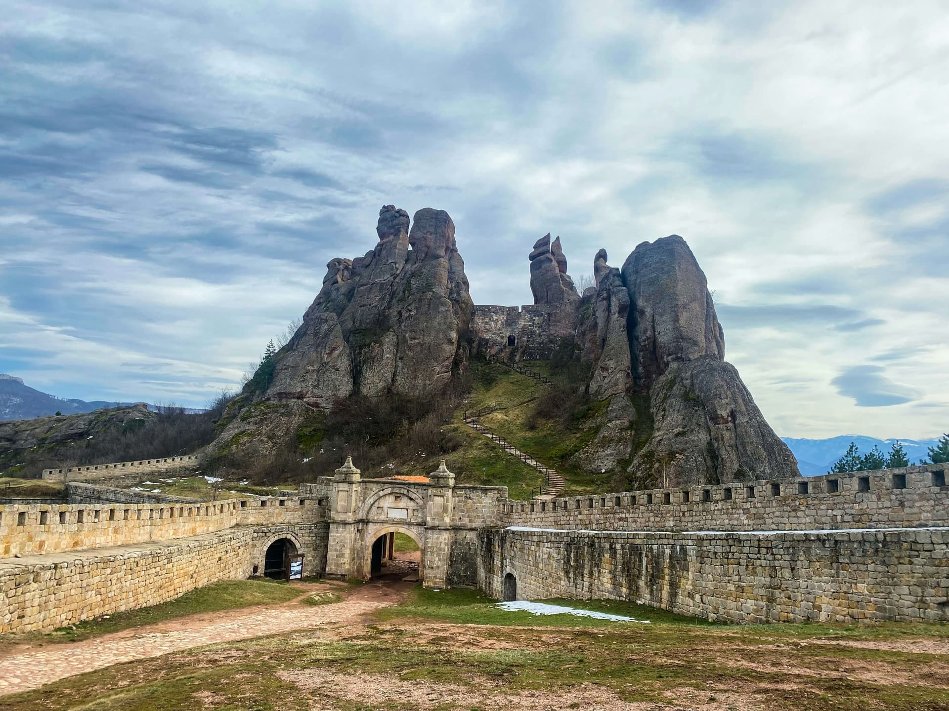
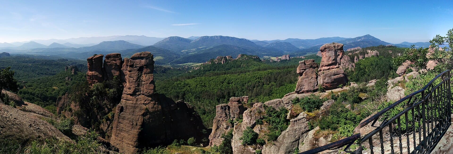
Belogradchik Rocks · Wikimedia Commons (CC-BY-SA)
North-West Bulgaria is one of the country's six planning regions and covers the oblasts of Vidin, Vratsa, Lovech, Montana, and Pleven. It spans 19,070 km² and has a population of around 756,000 (2018). Pleven is the region's largest city and economic centre.
Geography & location
The region occupies the north-western corner of the country and benefits from a favourable geographic position, international transport corridors along the Danube, and strong opportunities for cross-border cooperation. Roads cross the territory connecting Sofia and southwestern Bulgaria with the northeast and the northern Black Sea coast, while the Danube riverside is linked to southern Bulgaria via the passes of the western and central Stara Planina. The economic role of the Danube ports is growing, with Lom serving as a key gateway for raw-material imports into the southwest, and the Vidin–Calafat and Oryahovo–Bechet ferry crossings carrying national-level traffic; the planned second Danube Bridge at Vidin is set to deepen the region's transport relevance further. To the north it borders Romania along the Danube, and to the west it borders Serbia.
Climate & natural resources
The climate is temperate-continental on the plains and alpine at higher elevations — conditions that, together with a varied relief, favour vegetables, cereals, and industrial crops in the lowlands, and orchard fruit and potatoes higher up. More than 10% of the territory is covered by Danube floodplain, around 50% by the Danube hill country — the region's main farming belt — and the south rises through the ridges of the Predbalkan into Stara Planina. The more significant mineral deposits include polymetallic and lead-zinc ores in the Chiprovtsi and Vratsa mountains, iron ore near Martinovo, limestones at Kunino and Beli Izvor, marble, granite around Berkovitsa, gypsum at Koshava, and clays in the Troyan and Pleven areas.
Rivers & water resources
The region's water resources come mainly from the lower courses of the Ogosta, Skat, Iskar, Vit, and Osam rivers. Modest in volume, they are used in an integrated way — for water supply, irrigation, and electricity generation through the Petrohan hydropower cascade. Mineral springs around Lovech and Troyan support balneotherapy and a growing spa-tourism scene.
Soils & farmland
The most important soil resources are chernozems, which cover more than 40% of the region, alongside alluvial-meadow and grey forest soils. Natural meadows and pastures, especially in the foothills of Stara Planina, provide favourable conditions for stockbreeding.
Forests
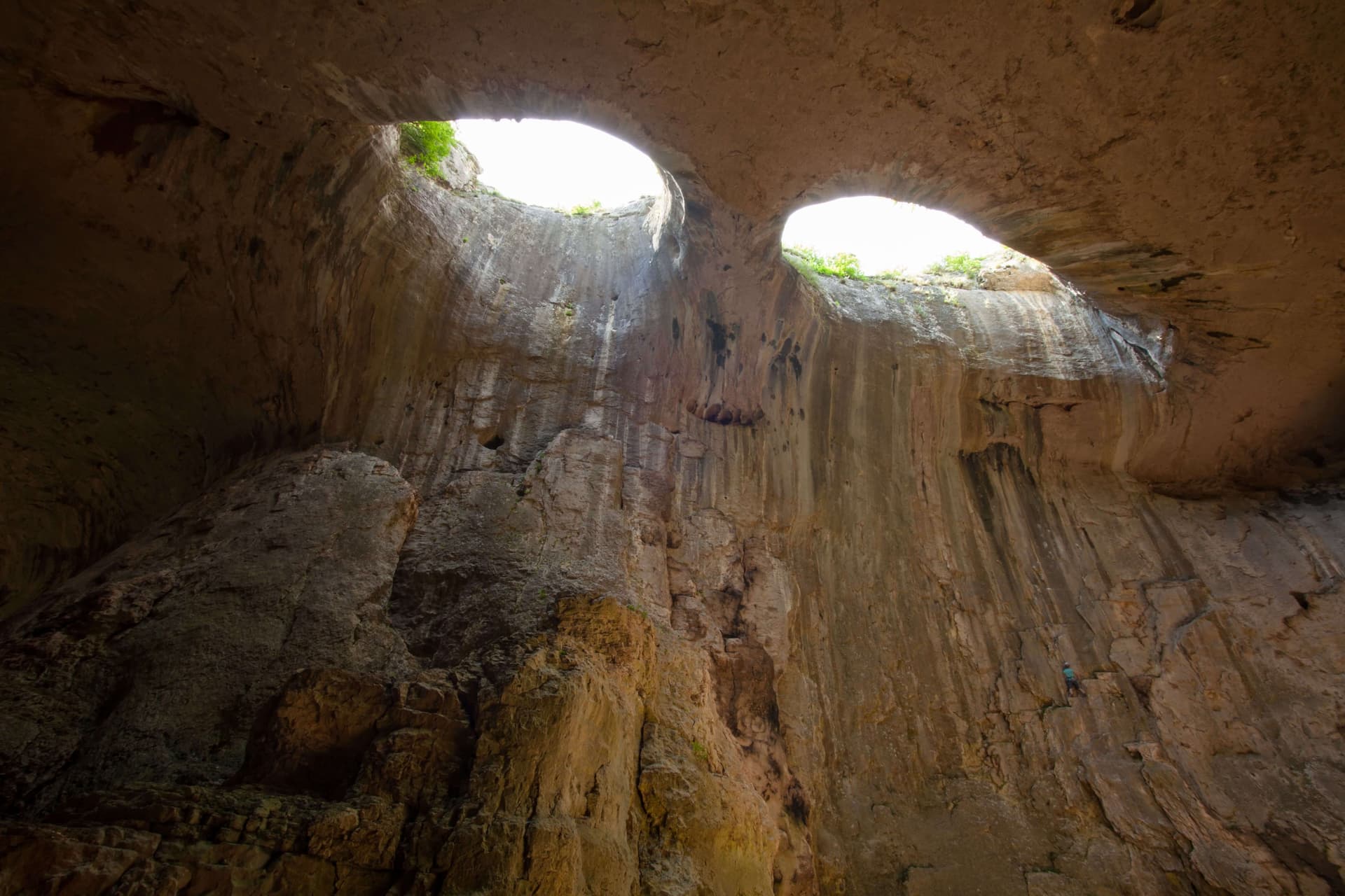
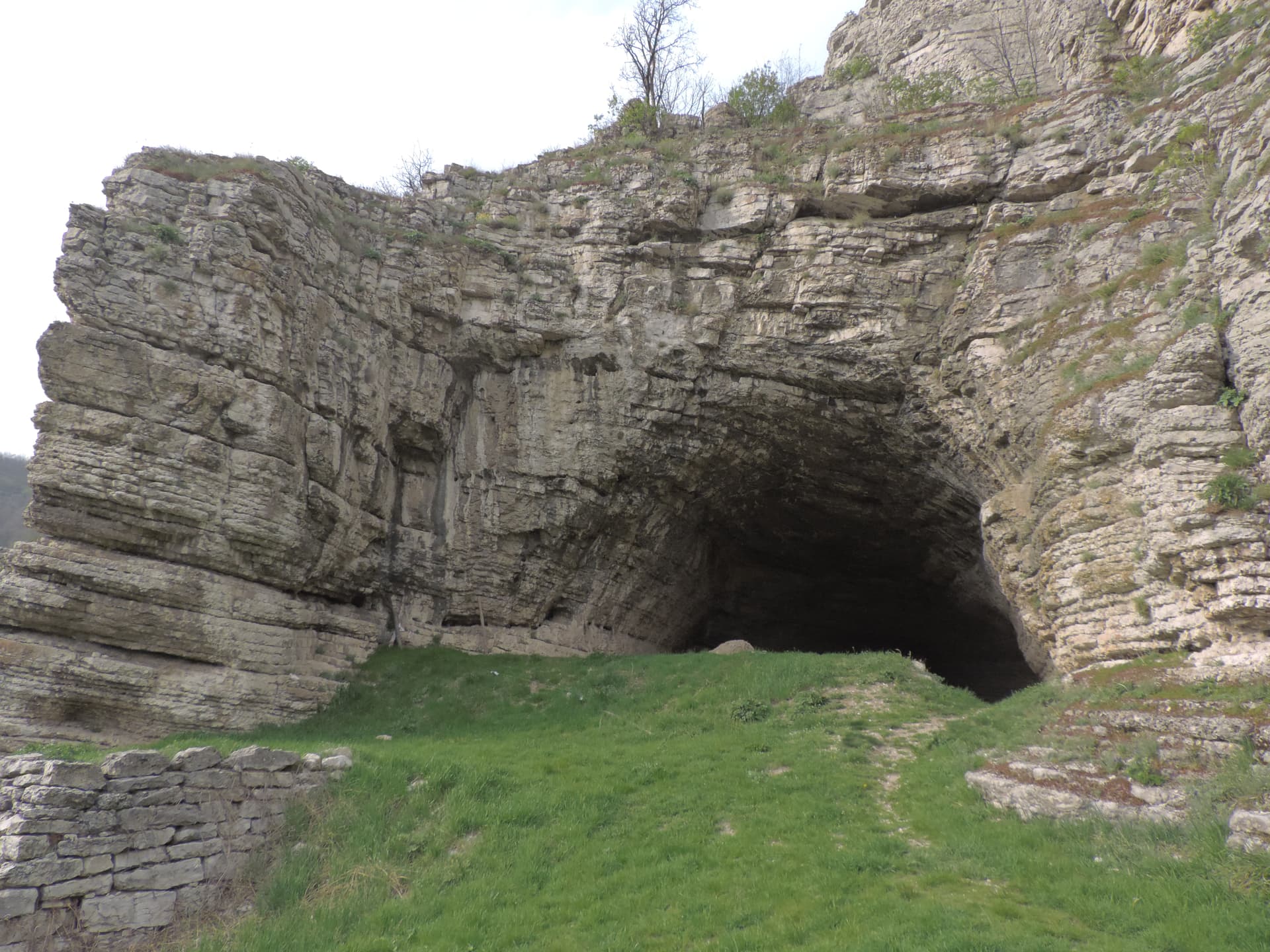
The most valuable forest resources are the rich beech stands on the northern mountain slopes, alongside other broadleaf species in the Predbalkan foothills and along the Danube tributaries. Protected areas — Vrachanski Balkan Nature Park, Balgarka Nature Park, and the reserves along the Iskar gorge — draw visitors for hiking, caving, and wildlife watching.
Population & settlements
North-West Bulgaria has the smallest population of any region in the country and it continues to decline, with a density of 39.6 people per km² — the lowest in Bulgaria. The difficult demographic picture drives a chain of problems — depopulation of the border and mountain areas, an ageing population, a steadily shrinking labour force, and an urban share that sits below the national average. In ethnic terms the region has a low share of ethnic Turks (1.8%) and a comparatively high share of Roma (6.6%).