


Vihren & Koncheto: Hiking Pirin's Marble Summit
In this guide▾
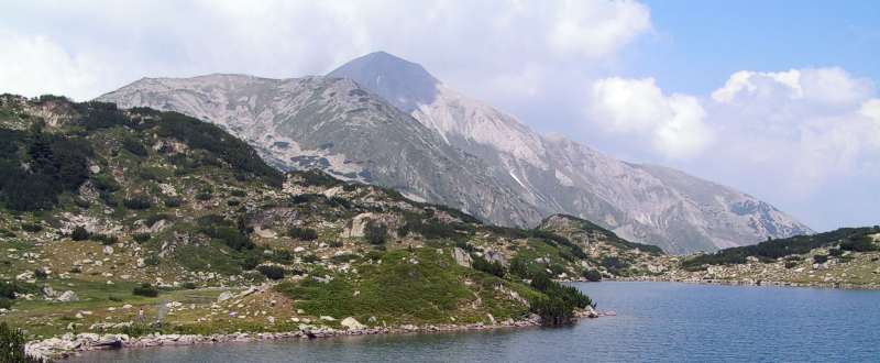
Rising in a great pyramid of pale marble, Vihren is the crown of the Pirin Mountains and, at 2,914 meters, the second-highest peak in Bulgaria — just eleven meters below Musala — and the third-highest on the Balkan Peninsula, after Musala and Greece's Mount Olympus. Where Rila is granite and glacial lakes, Pirin is sharp white marble, and Vihren is its most commanding summit.
This guide covers the classic climb from the Vihren hut above Bansko, plus the notorious Koncheto ridge next door — one of the most dramatic and exposed traverses in the country. We'll walk through getting there, the summer car ban, the route, the difficulty, the season, and what you need to take on this serious high mountain.
📍 Where Is Vihren?
Vihren stands in Pirin National Park, a UNESCO World Heritage site in Bulgaria's southwest, directly above the mountain town of Bansko. The climb begins at the Vihren hut (Hizha Vihren), at around 1,970 meters, reached by a 16 km asphalt road that winds up from Bansko through the Banderitsa valley.
🚗 Distances & Getting to the Trailhead
The climb starts at the Vihren hut. First reach Bansko, then continue up the mountain road to the hut:
| From | Distance to Bansko | Driving time |
|---|---|---|
| Sofia | ~160 km | ~2 h 30 min |
| Plovdiv | ~155 km | ~2 h 45 min |
| Blagoevgrad | ~60 km | ~1 h 15 min |
| Bansko → Vihren hut | ~16 km | ~30–40 min |
By car: From Sofia, take the A3 Struma motorway south, then the road via Simitli and Razlog to Bansko, and finally the mountain road up to the hut. The road is asphalt all the way and fine for ordinary cars, but the final stretch is narrow and winding.
The summer car ban: Bansko municipality closes the last 6 km, from the Shiligarnika car park to the hut, to private cars in the busy season. In 2026 the ban ran from 10 July to 15 September, every day from 08:00 to 16:00 — you cannot drive or park on that section in those hours. Drive up before 08:00, or leave the car at Shiligarnika and take the bus. The dates are set each year, so check before you go. In the ski season (roughly mid-December to mid-April) the same section is closed to cars, because the road crosses the pistes.
By bus: A seasonal bus line runs Bansko – Shiligarnika – Vihren hut from 1 June to 30 October. It leaves from in front of Bansko railway station, stops at hotels and at Shiligarnika on the way, and takes about 50 minutes. A one-way ticket is €8 (checked September 2026):
| From Bansko station | Arrives at the hut | From the hut | Arrives in Bansko |
|---|---|---|---|
| 08:30 | 09:21 | 09:30 | 10:20 |
| 13:20 | 14:10 | 14:20 | 15:07 |
| 17:00 | 17:49 | 18:00 | 18:50 |
For a summit day, the 08:30 bus up and the 18:00 bus down are the practical pair. Buses connect Sofia and Blagoevgrad with Bansko, so you can do the whole trip without a car.
Parking: the car park by the hut holds only about 10 cars, and on summer weekends far more cars than that try to squeeze in along the road. The larger alternative is the car park at Shiligarnika, 6 km below the hut, where the bus stops; a space there costs about €15 for 07:00–19:00 (checked September 2026).
🥾 The Standard Route: Vihren Hut to Summit
Two marked trails climb from the Vihren hut to the summit:
- The southern route via Kabata — the usual way up and the easier of the two. About 3.5 km and around 940 meters of ascent, taking 2.5 to 3.5 hours up and about 2 hours down.
- The northern route via Kazanite and Premkata — through the Kazanite ("the Cauldrons") cirque to the Premkata saddle between Vihren and Kutelo, then up to the summit. It is steeper, with chain-secured sections, and better saved for the descent or for experienced hikers.
Difficulty: strenuous. A sustained, steep climb over rocky and often loose marble. No technical climbing on the southern route, but real stamina and sure footing are needed. There is no water above the hut — carry all you need.
The reward at the top is a vast Pirin panorama — a sea of pale marble peaks and, far below, the glacial lakes that dot the range. Neighbouring Kutelo (2,908 m), Pirin's second summit, rises just to the northwest along the main ridge.
⚠️ The Koncheto Ridge — For Experienced Hikers Only
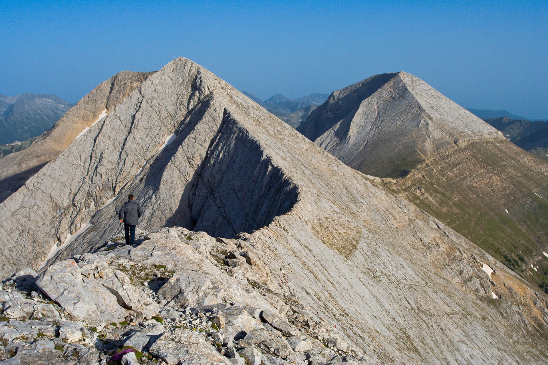
Beyond Kutelo lies Koncheto — "the little horse" — one of the most breathtaking and serious ridges in the Balkans. It's a narrow marble crest barely wide enough to walk along, with sheer drops of several hundred meters on both sides and a fixed steel cable bolted along the top for security.

- This is not part of the normal Vihren climb. It is a genuinely exposed traverse for experienced, sure-footed hikers with a strong head for heights, ideally in settled weather.
- The nearby Koncheto refuge shelters those crossing between Banski Suhodol and the Vihren–Kutelo massif.
- Never attempt it in wind, wet rock, poor visibility or snow. If in doubt, admire it from Kutelo and turn back — the standard Vihren summit is a full, satisfying objective on its own.
🗓️ Season, Weather & What to Bring
- Mid-July to late September is the safe hiking window — largely snow-free rock and open huts.
- June often still holds snow on the high marble slopes; check conditions.
- October to June is full winter mountaineering: crampons, ice axe, avalanche awareness and experience required.
- Crowds: summer weekends are the busiest time on the trail and at the hut. A weekday start at dawn gives you a quieter summit and the clearest views.
Pirin's weather changes fast, and the marble becomes slick when wet. Even in summer, carry warm and windproof layers, a rain shell, sun protection, at least 2 liters of water, food, and boots with solid grip. Start early to be off the summit and any ridge before the afternoon storms.
👨👩👧👦 Is It Suitable for Children?
The summit is not for young children — the climb is long, steep and loose, and the drops near the top are real. Fit teenagers used to mountain days can manage the southern route in good weather.
For families, stay low: Okoto lake is about 15 minutes from the hut, and the heart-shaped Muratovo lake about an hour, on easy mountain paths. Neither the trails nor the hut surroundings work for pushchairs; bring a child carrier instead.
🛏️ Where to Stay
- Bansko: the obvious base — a lively town with hotels, guesthouses and restaurants for every budget, and the start of the bus line to the hut.
- Vihren Hut (Hizha Vihren): beds right at the foot of the peak for about €20 per person (checked September 2026) — ideal for a dawn start, and a way around the summer car ban, since you are already at the trailhead. There are five double rooms, a four-bed room and dormitories of 5, 6, 8, 10, 10 and 12 beds, plus bungalows outside: four sleeping 3, four sleeping 4 and one sleeping 7. Facilities are basic — a shared bathroom on the ground floor, an outdoor toilet and an indoor one on the second floor.
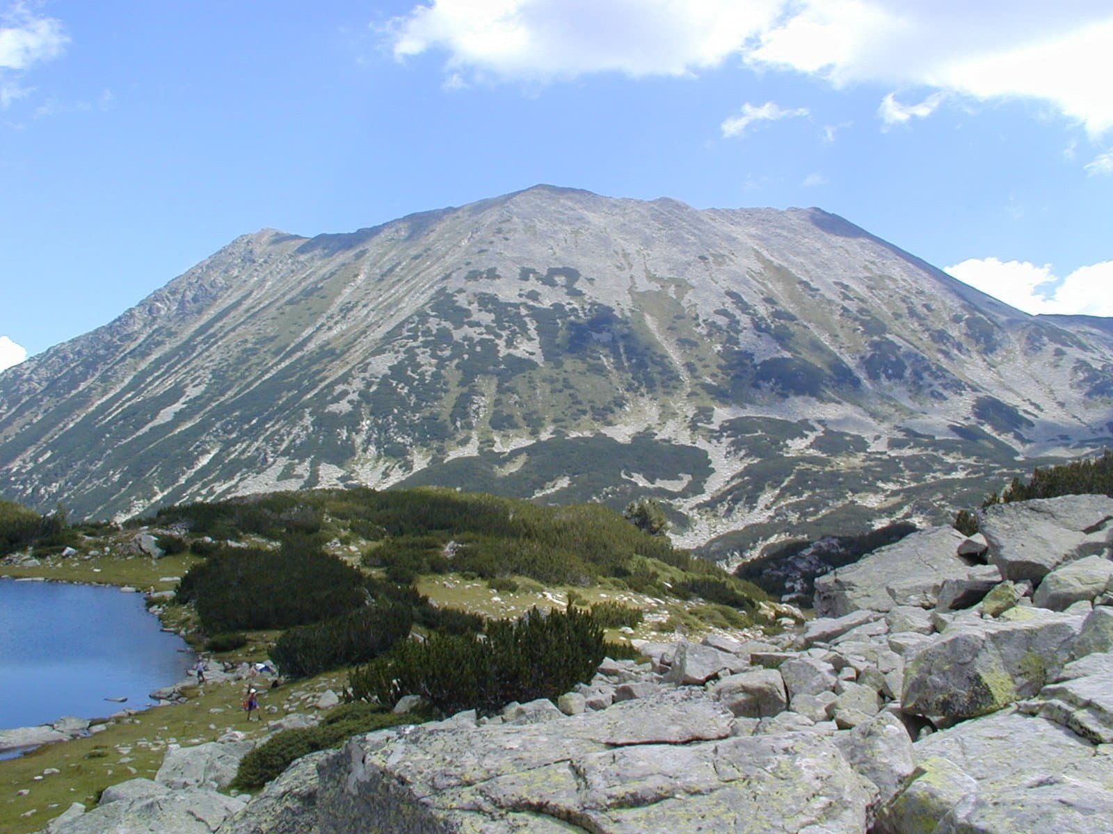
- Bansko doubles as a summer and winter destination — climb Vihren in the warm months and ski above the same town in winter, with its own summit, Todorka, overlooking the pistes. Compare it with the other resorts in our Borovets vs Bansko vs Pamporovo guide.
🧭 What Is Nearby
- Bansko (~30–40 min) — the old town with its stone houses, churches and restaurants, for the evening after the climb.
- Razlog (~15 min from Bansko) — the neighbouring town at the foot of Pirin and Rila, with cheaper lodging.
- Dobrinishte (~15 min from Bansko) — a small spa town with mineral baths and the chairlift up to Bezbog, a quieter door into Pirin.
For context on how Vihren ranks among the country's giants, see our guide to the highest peaks of Bulgaria — and pair it with the roof of the Balkans, Musala, for a two-peak trip across Pirin and Rila.
Vihren is Pirin at its most magnificent — a marble summit and, for the bold, one of the Balkans' great ridges. Plan your climb and keep exploring Bulgaria's mountains with Mestala.com.
This guide covers 7 places
Want more Mestala in your Google results?
Add mestala.com as a preferred source and our guides will show up more often when you search. Requires a Google account.
Frequently Asked Questions
How high is Vihren and where is it?▾
Vihren is 2,914 meters — the highest peak in the Pirin Mountains and the second-highest in Bulgaria and the third-highest on the Balkan Peninsula, after Musala and Greece's Mount Olympus. It stands in Pirin National Park, a UNESCO World Heritage site, and is climbed from the Vihren hut, 16 km above the town of Bansko, in southwestern Bulgaria.
How do you climb Vihren?▾
The standard summer route starts at the Vihren hut (around 1,970 m), 16 km by asphalt road from Bansko. From the hut, the marked southern trail via Kabata climbs steeply over rocky marble to the summit in about 2.5 to 3.5 hours, gaining around 940 m. It's a strenuous but non-technical hike for fit walkers with sturdy boots. A steeper northern route via the Kazanite cirque and the Premkata saddle has chain-secured sections.
What is the Koncheto ridge and is it dangerous?▾
Koncheto ('the little horse') is a narrow marble knife-edge ridge between Kutelo and Banski Suhodol peaks, with sheer drops of hundreds of meters on both sides and a fixed steel safety cable along the crest. It is spectacular but genuinely exposed and only for experienced, sure-footed hikers with a head for heights — not part of the normal Vihren ascent.
How hard is the Vihren hike?▾
Reaching Vihren's summit by the standard route is strenuous: a sustained, steep climb of around 940 meters over loose and rocky marble, taking a full mountain day round trip. No technical climbing is needed, but good fitness and footing are essential. Adding the Koncheto ridge raises the difficulty and exposure sharply.
Can you drive to Vihren hut?▾
Yes, by a 16 km asphalt road from Bansko, but with limits. In summer (10 July to 15 September in 2026) cars may not drive or park between the Shiligarnika car park and the hut from 08:00 to 16:00, and in the ski season the same section is closed to cars. The hut car park holds only about 10 cars, and a space at Shiligarnika costs about €15 for 07:00–19:00. The alternative is the Bansko–Vihren hut bus, which runs 1 June to 30 October and costs €8 one way (checked September 2026).
When is the best time to climb Vihren?▾
Mid-July to late September is the reliable window, when the trails are largely snow-free and the huts are open. Snow lingers on the high marble slopes into summer and returns by October. Outside this season Vihren is a serious winter mountaineering objective demanding crampons, an ice axe and avalanche awareness.
Where do you stay to climb Vihren?▾
Most hikers stay in Bansko, a lively mountain town with plenty of hotels, then drive or take the summer bus up to the Vihren hut trailhead. In summer, cars are banned on the last 6 km to the hut between 08:00 and 16:00, so drive up early or use the bus. For an early start you can overnight at the Vihren hut itself, right at the foot of the peak, where a bed costs about €20 per person (checked September 2026). Bansko also works well as a summer base combined with its winter ski scene.
You might be interested in

The 7 Highest Peaks of Bulgaria: A Summit-by-Summit Guide
The highest peak of every major Bulgarian mountain — Musala, Vihren, Botev and more, with elevations, difficulty, base towns and how to climb each.
Botev Peak & Raysko Praskalo: Hiking the Central Balkan
How to hike Botev Peak (2,376 m), the highest summit of the Balkan Mountains, from Kalofer — past Raysko Praskalo, the highest waterfall in the Balkans.

Cherni Vrah: Hiking Vitosha's Summit from Sofia
How to hike Cherni Vrah (2,290 m), the summit of Vitosha above Sofia — the route from Aleko, bus 66, the lifts that still run, difficulty, and season.
The Kom–Emine Trail: Bulgaria's Great Balkan Traverse
A guide to the Kom–Emine trail, Bulgaria's ~600 km E3 traverse of the Balkan Mountains from Kom Peak to the Black Sea: route, stages, water, huts and season.