

The Kom–Emine Trail: Bulgaria's Great Balkan Traverse
In this guide▾
Stretching some 600 kilometers along the spine of the Balkan Mountains, Kom–Emine is Bulgaria's longest waymarked trail — a full west-to-east traverse of the country on foot, from a peak near the Serbian border to a cape on the Black Sea. It's the Bulgarian section of the pan-European E3 path, and completing it is a rite of passage among the country's hikers.
This guide covers what the trail is, its route and highlights, how long it takes, water, huts, difficulty and season, and how to sample the best sections if three weeks on the ridge isn't in the cards.

🧭 What Is Kom–Emine?
Kom–Emine follows the main ridge of the Stara Planina — the Balkan Mountains that run the entire length of Bulgaria and give the peninsula its name. It forms part of the European long-distance path E3, which links the Atlantic with the Black Sea.
The classic direction is west to east:
- Start — Kom Peak (2,016 m): above the town of Berkovitsa in the western Balkan Mountains. See our Montana, Berkovitsa and Kom guide.
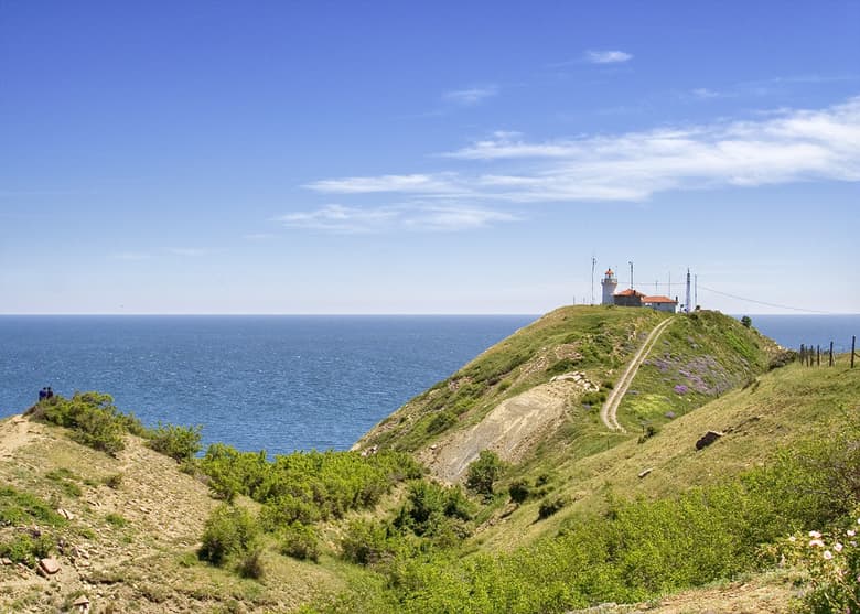
- Finish — Cape Emine: where the Balkan ridge finally drops into the Black Sea, near the village of Emona between Obzor and Sunny Beach.
New in 2026: the E3 has been extended 125 km further west, from Kom to Vrashka Chuka on the Serbian border, the symbolic beginning of the Balkan range. The classic Kom–Emine route is unchanged, but if you want to walk the whole Bulgarian E3, it now starts there.
🚗 Getting to the Start and Back from the Finish
To the start: Berkovitsa
- By bus: buses from Sofia take just under 2 hours over the Petrohan Pass. The lines are often run by regional companies, so check current times directly with the bus station.
- By train: there is no direct train. Take a train from Sofia to Boychinovtsi and change for Berkovitsa; the journey takes about 3.5–4 hours. Check the timetable on the BDZ website.
- Up to Kom hut: from Berkovitsa, the new Kom hut is 3–4 hours on foot, or a taxi ride up the 15 km asphalt road.
From the finish: Cape Emine
The trail ends at Cape Emine, by the village of Emona, which has no regular public transport, and there is no phone signal at the cape itself. The nearest transport hubs are Sunny Beach, Burgas and Varna. Plan the way out before you arrive:
- Get away from Emona:
- On foot to Irakli beach — about 6–7 km on a dirt road. In summer it is much easier to find a taxi or a shared ride from there.
- On foot to the village of Banya — about 13 km to the main E87 road, where all buses between Burgas and Varna stop.
- By taxi from Emona — pre-book one from Sunny Beach or Sveti Vlas. The road to Emona is rough dirt, so check the driver is willing.
- Head home:
- Via Burgas: regular buses run from Sunny Beach to Burgas South bus station, and Burgas has direct trains and dozens of buses a day to Sofia and Plovdiv, as well as an airport.
- Via Varna: from Banya, a bus north to Varna connects with trains and buses to northern Bulgaria and Sofia.
Joining or leaving mid-route
The trail crosses the road network at mountain passes such as Petrohan, Troyan, Shipka and Vratnik, so you can walk a section or bail out if the weather turns.
🗺️ The Route & Its Highlights
The trail links the whole chain of the Balkan Mountains, from rolling western pastures to the wild, high central massif and down to the coast. Along the way it passes some of the range's greatest landscapes:
- The high heart — Botev Peak: the central section climbs over Botev, at 2,376 m the highest summit of the Stara Planina, through Central Balkan National Park — the toughest and most dramatic stretch. Between Dobrila hut and Botev, the route crosses Kupena, a rocky scramble with chains where you need your hands.
- Shipka and Buzludzha: further east the trail crosses the historic Shipka Pass and passes the surreal Buzludzha monument on its summit.
- The eastern run to the sea: the final days descend through lower, quieter, drier hills to Cape Emine.
See how the peaks along the way fit into the bigger picture in our guide to the highest peaks of Bulgaria.
⏱️ How Long Does It Take?
- Distance: roughly 600–650 km along the ridge for the classic route. Detours down to huts and villages add more.
- Ascent: around 18,500 m of cumulative climbing.
- Duration: moderately fit hikers usually take about 21 days, walking 7 to 12 hours a day and covering 25–35 km. The 30 conventional stages below are the building blocks — combine them to suit your pace, and add rest and weather days.
It's a genuine multi-week expedition — a physical and logistical commitment rather than a holiday hike.
🪜 The 30 Stages
The route is conventionally divided into 30 stages, usually hut to hut or pass to pass. Fit hikers often combine some of them to finish in about three weeks. Most stages have several variants — along the ridge, on contouring paths, or via a hut — which matter when the weather turns or you need a bed.
| # | Stage | Worth knowing |
|---|---|---|
| 1 | Berkovitsa – new Kom hut – old Kom hut – Kom Peak | Direct marked paths leave from the centre of Berkovitsa |
| 2 | Kom Peak – Petrohan Pass – Petrohan hut | No real alternatives; summer and winter paths split in places |
| 3 | Petrohan hut – Chervenata Lokva – Proboynitsa hut | The unmarked forest road to the hut is easier on a bike than the marked path |
| 4 | Proboynitsa hut – Gubislav – Lakatnik station – Lakatnik village – Trastenaya hut | A newly marked path after Gubislav avoids the old mines |
| 5 | Trastenaya hut – Berilova Vodenitsa – Chukava – Sveti Duh – Leskova hut | Good spring just below the path at the foot of Izdremets |
| 6 | Leskova hut – Mechulitsa – Beliya Kamak | — |
| 7 | Beliya Kamak – Zla Polyana – Vitinya | Three variants to Zla Polyana; drinking fountain below it |
| 8 | Vitinya – Arabakonak – Stargelska Mandra – Etropole Pass | Drinking fountain at Arabakonak; unmarked roads suit bikes |
| 9 | Etropole Pass – Hadzhiytsa – Kashana | Ridge, road or Chavdar hut variants; Murgana hut as an option |
| 10 | Kashana – Kosishki Pass – Planinski Izvori | Ridge or Svishtiplaz hut variants; Momina Polyana hut for a bed; water north of the pass |
| 11 | Planinski Izvori – Antonski Pass – Kamennata Porta – Eho hut | Over Vezhen along the ridge, or via Benkovski and Vezhen huts in bad weather |
| 12 | Eho hut – Kozya Stena hut – Troyan Pass | Water at the saddle before the pass |
| 13 | Troyan Pass – Orlovo Gnezdo – Dermenka – Dobrila hut | Two variants around Dermenka and Gerdektepe |
| 14 | Dobrila hut – Botev shelter | Ridge route, or the southern contour via Vasil Levski hut |
| 15 | Botev shelter – Botev Peak – Tazha hut – Mazalat hut | Ridge or contouring variants around Paradzhika and Tazha |
| 16 | Mazalat hut – Partizanska Pesen – Uzana – Shipka – Buzludzha | Bike variant via the Geographic Centre; camping at Shipka |
| 17 | Buzludzha – Bedetsite – Balgarka – Krastets station | Contouring path around Bedetsite |
| 18 | Krastets station – Gramadliva hut – Predela hut | Several springs along the way |
| 19 | Predela hut – Buturski Chukar – Karaivanovo Horishte shelter | An easy unmarked road after the fountain; spring by the shelter |
| 20 | Karaivanovo Horishte shelter – Bukovets hut – Chumerna hut | Walking and bike variants; several springs |
| 21 | Chumerna hut – Vratnik shelter | Over the peak or along the road; fountains below Chumerna and at Aglikina Polyana |
| 22 | Vratnik shelter – Deliradeva Buka – Zurlyova Mandra – Kotel | Three ways down to Kotel; new and old fountains along the route |
| 23 | Kotel – Tsiganski Grob – Karakus – Varbitsa Pass, or Kotel – Gerila river – Varbitsa resort | Two ways to Golyamata Niva: over the ridge via Varbitsa Pass, recently walked again after years out of use, or down the Gerila river past the resort, with fountains and places to shelter |
| 24 | Varbitsa Pass – Kaleto – Golyamata Niva, or Varbitsa resort – Eleshnitsa – Golyamata Niva | Nearby springs are marked, plus the signed turn-off to the Golyamata Besedka |
| 25 | Golyamata Niva – Debeltsite – Rish Pass | Along the Gerisha ridge or by the road to the south |
| 26 | Rish Pass – Hazim Gorski shelter – Daskotna | North and south variants to the shelter; Luda Kamchia hut is in ruins |
| 27 | Daskotna – Dobra Polyana – Topchiysko | Detour to Topchiysko hut for a bed |
| 28 | Topchiysko – Sini Rid – Kozichino | Around Dobrovan, the road and the field path are both 3.5 km — the road is faster, the field path passes the stone mushrooms |
| 29 | Kozichino – Dyulino Pass – Gyoztepe – Plazovets – Pomorie Pass | Two ways onto the pass, depending on how you take the last stage |
| 30 | Pomorie Pass – Sveti Iliya – Emona – Cape Emine | A reliable fountain below the ruined Piknika restaurant; the one on the pass often runs dry |
⚠️ Difficulty & Logistics
- Difficulty: demanding but mostly non-technical — long days, big distances and serious mountain conditions. The exception is the Kupena section between Dobrila hut and Botev, where there are chains and you need a head for heights.
- Waymarking: the route is marked with red paint and signposts, and the exposed ridge sections have black-and-yellow winter marker poles. Quality varies: the central section is well marked, the western and eastern parts less so. Carry a map and GPS track, because fog can wipe out visibility on the ridge.
- Water: reliable in the west and centre in early summer, but some ridge stages have no drinkable water at all, and the east is much drier. Carry enough for the whole day and refill at every spring.
- Accommodation: a network of mountain huts (hizhi) and free shelters lines the route. A bed costs around €20 per person on average (checked September 2026), a little more in some huts and less in others. Some are small, so book ahead in high season, and bring cash — few huts take cards. The eastern end has stages with no hut, where you need a tent.
- Resupply: the trail passes near villages and mountain passes with shops, so you rarely need to carry more than a few days of food.
- Wildlife and dogs: brown bears live in Central Balkan National Park, and you will meet shepherd dogs guarding flocks on the high pastures. Keep your distance and follow park rules.
- Phone signal: mobile coverage is good along most of the ridge, but don't rely on it in fog or for navigation.
🗓️ Best Time to Hike
- Mid-June to mid-July is the sweet spot — the high ridge is largely snow-free, the huts are open, springs are still running and there are fewer people.
- Late July and August are busier and hotter, with huts filling up and water getting scarce in the east.
- The Balkan Mountains are notorious for fast, fierce weather: fog, wind and thunderstorms can strike even in midsummer, especially on the high central sections, and storms become more frequent towards September. Build in flexible days.
- Outside summer, the central massif around Botev becomes full winter mountaineering terrain and is not a casual undertaking.
👨👩👧👦 Is It Suitable for Children?
The full traverse is not for children. Teenagers with hiking experience can manage short hut-to-hut sections in summer, for example a day or two from Berkovitsa over Kom, as long as you avoid the Kupena scramble and plan around water. Nothing on the ridge is suitable for pushchairs.
🥾 Don't Have Three Weeks? Hike a Section
You don't need to walk the whole thing to taste it. The best multi-day segments include:
- Berkovitsa over Kom Peak — the classic start, with open grassy ridges and easy road access at Petrohan.
- The central Botev massif in Central Balkan National Park — the highest, wildest and most spectacular stretch, with big hut-to-hut days.
- Shipka to Buzludzha — a shorter stretch linking two of Bulgaria's best-known historic sites.
- The eastern descent to Cape Emine — a rewarding finish at the Black Sea, easily combined with a few days on the coast.
Most of these sections take 2–5 days. Section-hiking lets you experience the grandeur of the Balkan ridge over a long weekend rather than a month.
Kom–Emine is the ultimate Bulgarian hike — the whole country traversed along its mountain spine, from a western peak to the eastern sea. Whether you take on the full ridge or just a section, plan your Balkan adventure with Mestala.com.
This guide covers 6 places
Want more Mestala in your Google results?
Add mestala.com as a preferred source and our guides will show up more often when you search. Requires a Google account.
Frequently Asked Questions
What is the Kom–Emine trail?▾
Kom–Emine is Bulgaria's longest waymarked hiking trail and the Bulgarian section of the European E3 path. It follows the main ridge of the Balkan Mountains (Stara Planina) from west to east across the entire country, from Kom Peak near the Serbian border to Cape Emine on the Black Sea coast — a full traverse of Bulgaria on foot.
How long is the Kom–Emine trail and how many days does it take?▾
The classic route from Kom Peak to Cape Emine is roughly 600–650 km, with around 18,500 m of cumulative ascent. The route is conventionally divided into 30 stages; moderately fit hikers who combine some of them usually take about 21 days, walking 7 to 12 hours a day. In 2026 the E3 was extended 125 km further west to Vrashka Chuka on the Serbian border, which brings the full Bulgarian E3 to 725–825 km depending on detours to huts and villages.
Where does Kom–Emine start and end?▾
The classic direction runs west to east, starting at Kom Peak (2,016 m) above Berkovitsa and finishing at Cape Emine on the Black Sea, near the village of Emona between Obzor and Sunny Beach. Kom hut, the usual starting base, is reached by a 15 km asphalt road from Berkovitsa. Emona and Cape Emine have no regular public transport: walk 6–7 km on a dirt road to Irakli beach, 13 km to the village of Banya on the main Burgas–Varna road, or pre-book a taxi from Sunny Beach or Sveti Vlas.
Is the Kom–Emine trail difficult?▾
Yes — it's a demanding multi-week mountain traverse. Most of it is non-technical, but the section between Dobrila hut and Botev Peak crosses Kupena, where you need your hands and there are chains. Days are long, some ridge stages have no drinkable water, waymarking is patchy in the western and eastern parts, and the weather can be severe, so you need solid fitness, map navigation and self-sufficiency.
Is there water on the Kom–Emine trail?▾
In the western and central sections there are reliable springs and huts in June and July. Some ridge stages have no drinkable water source at all, and the eastern section is much drier, especially later in summer. Carry enough water for the whole day and refill at every opportunity.
When is the best time to hike Kom–Emine?▾
Mid-June to mid-July is the best window: the high ridge is largely clear of snow, the huts are open, water is still flowing and there are fewer people. Late July and August are busier and hotter, with huts filling up, and late-summer thunderstorms are common. Outside summer, the high central sections become full winter mountaineering terrain.
Can you hike just part of the Kom–Emine trail?▾
Absolutely — most people walk it in sections. Popular choices are the start from Berkovitsa over Kom Peak, the high central stretch over Botev Peak in Central Balkan National Park, and the final days down to Cape Emine. The trail crosses roads at mountain passes such as Petrohan, Troyan, Shipka and Vratnik, which makes it easy to join or leave.
Where do you sleep on the Kom–Emine trail?▾
Mostly in mountain huts (hizhi) and free shelters along the ridge. A night in a hut costs around €20 per person on average (checked September 2026). Some huts have limited capacity, so book ahead in high season, and expect to pay in cash at most of them. The eastern end has stages without huts, where you need a tent.
You might be interested in
Botev Peak & Raysko Praskalo: Hiking the Central Balkan
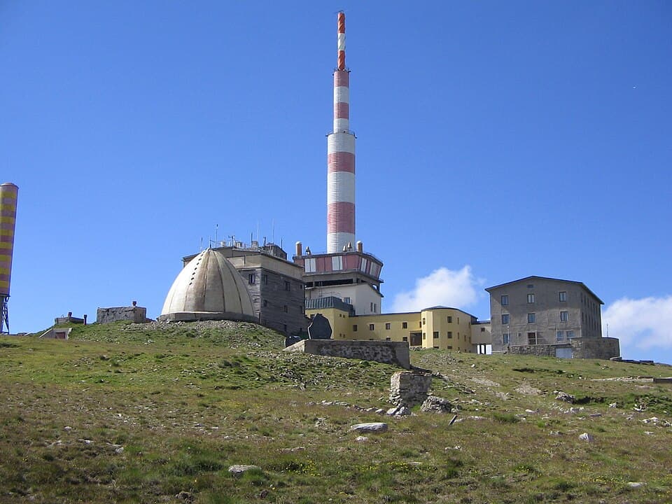
How to hike Botev Peak (2,376 m), the highest summit of the Balkan Mountains, from Kalofer — past Raysko Praskalo, the highest waterfall in the Balkans.

Cherni Vrah: Hiking Vitosha's Summit from Sofia
How to hike Cherni Vrah (2,290 m), the summit of Vitosha above Sofia — the route from Aleko, bus 66, the lifts that still run, difficulty, and season.
Malyovitsa: Rila's Most Iconic Day Hike
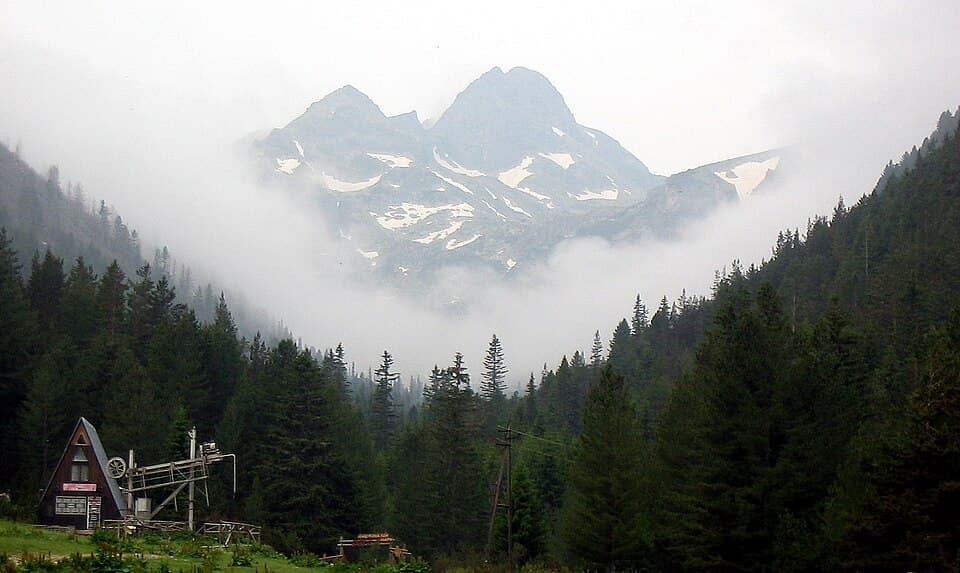
How to hike Malyovitsa (2,729 m), the cradle of Bulgarian mountaineering in northern Rila — the route from the resort and hut, parking, difficulty and season.
The 7 Highest Peaks of Bulgaria: A Summit-by-Summit Guide
The highest peak of every major Bulgarian mountain — Musala, Vihren, Botev and more, with elevations, difficulty, base towns and how to climb each.