

Malyovitsa: Rila's Most Iconic Day Hike
In this guide▾
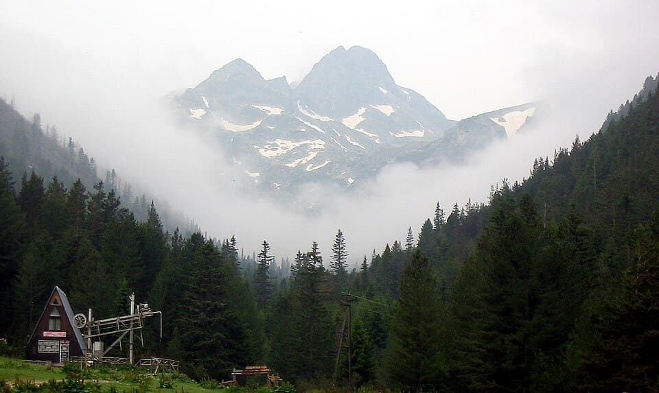
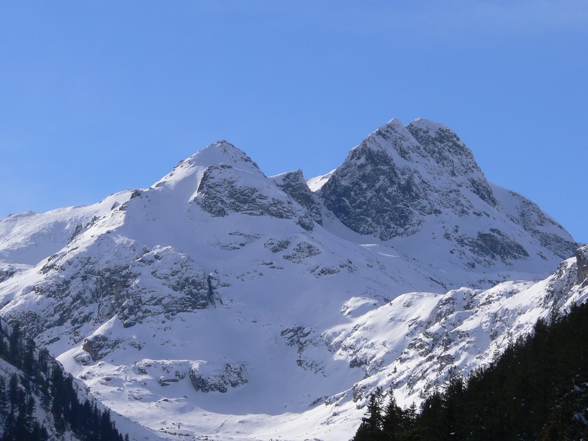
Not the highest peak in Rila, but arguably its most beloved, Malyovitsa rises to 2,729 meters in the range's wild northwestern corner. Its elegant pyramid and sheer north face have made it an emblem of Bulgarian mountaineering — this is where the country's alpinists learned their craft, including Hristo Prodanov, the first Bulgarian on Everest.
For hikers, Malyovitsa is the perfect step up: a genuine high Rila summit that a reasonably fit walker can reach and return from in a day, without the length of Musala or the exposure of Vihren. This guide covers getting there, the route from the resort and hut, parking, difficulty, timing and where to stay.
📍 Where Is Malyovitsa?
Malyovitsa stands in the northwestern Rila Mountains inside Rila National Park, the same great massif that holds Musala, the Seven Rila Lakes and, on its western flank, Rila Monastery. The climb begins at the Malyovitsa resort, at the end of the road up the valley from the village of Govedartsi near Samokov — within easy reach of the capital.
🚗 Distances & Getting to the Trailhead
The hike starts at the Malyovitsa resort (1,723 m), 26 km southwest of Samokov. The last 18 km from Govedartsi are asphalt, following the Malyovitsa river. Approximate driving distances:
| From | Distance | Driving time |
|---|---|---|
| Sofia | ~90 km | ~1 h 30 min |
| Borovets | ~35 km | ~45 min |
| Plovdiv | ~160 km | ~2 h 30 min |
By car (recommended): From Sofia, drive to Samokov, then through Govedartsi up the valley to the resort. The road is asphalt and maintained, but drive carefully: it has plenty of bends and some uneven patches.
Parking: the state car park at the resort costs about €5 per day, and there are a few free spaces higher up by the old mountaineering school building. The fee is due only at the state car park — if a private lot asks you to pay, the charge may not be lawful. On summer weekends parking fills early — arrive by 7:00.
By public transport: take a bus from Sofia to Samokov, then the minibus from Samokov bus station to the resort. Departures have been at around 08:15, 09:15, 15:30 and 16:15, but the times vary and are subject to change, so check the current timetable with Samokov bus station before you go. A taxi from Samokov is the flexible option. Because it's so close to the capital, the peak makes an excellent addition to a few days in Sofia.
🥾 The Route: Resort to Summit
The standard route has three stages:
- Resort to Malyovitsa hut (~1,960 m): about 1 hour. Follow the blue markings through forest for the first 40 minutes, then across open ground to the hut. The hut has the last reliable tap water.
- Hut to Elenino Lake (2,479 m): about 2 hours. From the hut, follow the red markings up over the first and second terraces, rocky steps in the valley with the north face of Malyovitsa looming above, to the small Elenino Lake in the cirque below the peak.
- Elenino Lake to the summit: about 1 hour. The path climbs steeply over rock and scree. About 10–15 minutes below the top, it runs along a narrow ledge above a big drop — no climbing is needed, but it is hard going for anyone afraid of heights.
- Totals: about 6.5 km and 1,000 m of ascent, 3.5–4 hours up and around 3 hours down the same way.
- Difficulty: moderate to strenuous. Well marked and popular, but mostly rocky above the hut and steep near the top.
- Water: carry at least 1.5 liters per person. After the hut, you are relying on streams, and there are none above Elenino Lake.
From the summit, the view stretches across the jagged Rila ridges and, on a clear day, all the way to Pirin. Experienced hikers can continue from the hut area to the Malyovitsa lakes (about 1 hour 10 minutes from the hut) or the Strashnoto Lake shelter (about 2.5 hours), and on toward the Seven Rila Lakes on a multi-day traverse.
🧗 The Cradle of Bulgarian Mountaineering
Malyovitsa isn't just a hike — it's the spiritual home of Bulgarian alpinism. The first organised mountaineering courses in Bulgaria began in 1949, and the Central Mountain School at the Malyovitsa resort went on to train generations of climbers. Among them was Hristo Prodanov, who graduated in 1961 and on 20 April 1984 became the first Bulgarian to summit Everest; he died on the descent. The school has carried his name since 1985 and keeps a museum in his memory. The area remains a hub for climbing, ski-touring and mountain training.
🗓️ Season, Weather & What to Bring
- July to September is the sweet spot — snow-free trail and green meadows.
- June can still hold snow on the upper slopes and summit rocks, and swollen streams can mean wet feet; check conditions.
- Winter and spring turn Malyovitsa into a serious mountaineering and ski-touring objective requiring proper gear and experience.
Even in summer, pack for fast-changing alpine weather: warm and windproof layers, a rain shell, sun protection, water, food, and boots with grip. Mornings are clearest — start early and be off the summit before the afternoon cloud and storms. An early start also beats the crowds: by late morning on summer weekends the path is busy.
👨👩👧👦 Is It Suitable for Children?
The summit is not for children: it's a long, rocky day with an exposed ledge near the top. The walk from the resort to Malyovitsa hut is a different story — about an hour on a clear path through forest and meadows, and a good family outing with the hut as the turning point. Neither route is suitable for pushchairs.
🛏️ Where to Stay
-
Malyovitsa Hut: about an hour above the resort, with a renovated floor of rooms and a bathroom with hot water — the best choice for an early start on the summit. Prices per person, except the bungalow (checked September 2026):
Room Price per person Two-bed room €23 Three-bed room €23 Four-bed room €20.45 Six-bed room €20.45 Eight-bed room €20.45 Two-bed bungalow €46.02 (whole bungalow) -
Malyovitsa resort: hotels and guesthouses right at the trailhead, and the easiest option if you arrive by car the night before.
-
Govedartsi: a village a little lower down with guesthouses and hotels, a quieter and usually cheaper valley base, 18 km from the trailhead.
-
Samokov / Borovets: larger bases nearby, handy if you're combining Malyovitsa with Musala or the Seven Rila Lakes.
🧭 What Is Nearby
- Borovets (~45 min) — Bulgaria's oldest mountain resort and the gondola start for Musala. See our Borovets guide.
- Samokov (~30 min) — the valley town once home to the Samokov school of icon painting, and the gateway to both Malyovitsa and Borovets.
- The Seven Rila Lakes (~1 h 15 min by car to Panichishte) — Rila's most famous lake walk. See our Seven Rila Lakes guide.
See where Malyovitsa sits among the country's highest peaks and build it into a wider mountain weekend.
Malyovitsa is Rila at its most graceful — an iconic summit and the birthplace of Bulgarian mountaineering, all within a day of Sofia. Plan your hike and keep exploring Bulgaria's mountains with Mestala.com.
This guide covers 3 places
Want more Mestala in your Google results?
Add mestala.com as a preferred source and our guides will show up more often when you search. Requires a Google account.
Frequently Asked Questions
How high is Malyovitsa and where is it?▾
Malyovitsa is 2,729 meters high, in the northwestern Rila Mountains of southwestern Bulgaria, inside Rila National Park. It rises above the Malyovitsa resort, reached by an 18 km asphalt road from the village of Govedartsi near Samokov, about 90 km from Sofia. Though not one of Rila's very highest peaks, it's one of its most beautiful and beloved.
How do you climb Malyovitsa?▾
The standard route starts at the Malyovitsa resort (1,723 m), where you park. A blue-marked path reaches Malyovitsa hut (about 1,960 m) in about an hour; from there, red markings lead over two rocky terraces to Elenino Lake (2,479 m) and up to the summit. The whole ascent is about 6.5 km and 1,000 m of height gain and takes 3.5 to 4 hours. Descend the same way.
Is Malyovitsa suitable for beginners?▾
Fit beginners with proper footwear can manage Malyovitsa in good summer weather, but it's a big day: about 1,000 m of ascent on mostly rocky ground. About 10–15 minutes below the summit, the path runs along a narrow ledge above a drop, which is hard for anyone afraid of heights. It's a great first 'real' Rila summit if you start early and head down if the weather worsens.
Is there parking at Malyovitsa?▾
Yes. The state car park at the Malyovitsa resort costs about €5 per day, and there are a few free spaces a little higher up by the old mountaineering school building. A fee is due only at the state car park; if someone charges you at a private lot, it may not be lawful. On summer weekends parking fills early, so arrive by 7:00.
Can you get to Malyovitsa without a car?▾
Yes, but it takes planning. Take a bus from Sofia to Samokov, then the minibus from Samokov bus station up to the Malyovitsa resort. Minibuses have run at around 08:15, 09:15, 15:30 and 16:15, but times vary and change, so check the current timetable with Samokov bus station before you rely on it. A taxi from Samokov is the flexible alternative.
Why is Malyovitsa famous?▾
Malyovitsa is known as the cradle of Bulgarian mountaineering. The Central Mountain School at the Malyovitsa resort has trained generations of climbers, among them Hristo Prodanov, who graduated in 1961 and in 1984 became the first Bulgarian to stand on Everest; he died on the descent. The school has carried his name since 1985 and keeps a small museum in his memory.
When is the best time to hike Malyovitsa?▾
July to September is ideal, when the trail is snow-free. June can still hold snow on the upper slopes and the final rocks, and streams can mean wet feet. Outside summer, Malyovitsa becomes a serious winter climb requiring proper equipment and experience.
Is Malyovitsa suitable for children?▾
The summit is not suitable for children: the route is long, rocky and has an exposed ledge near the top. The walk from the resort to Malyovitsa hut, about an hour through forest and then open meadows, is a good family outing, with the hut's terrace as the turning point.
You might be interested in

Cherni Vrah: Hiking Vitosha's Summit from Sofia
How to hike Cherni Vrah (2,290 m), the summit of Vitosha above Sofia — the route from Aleko, bus 66, the lifts that still run, difficulty, and season.
Climbing Musala: Bulgaria's & the Balkans' Highest Peak
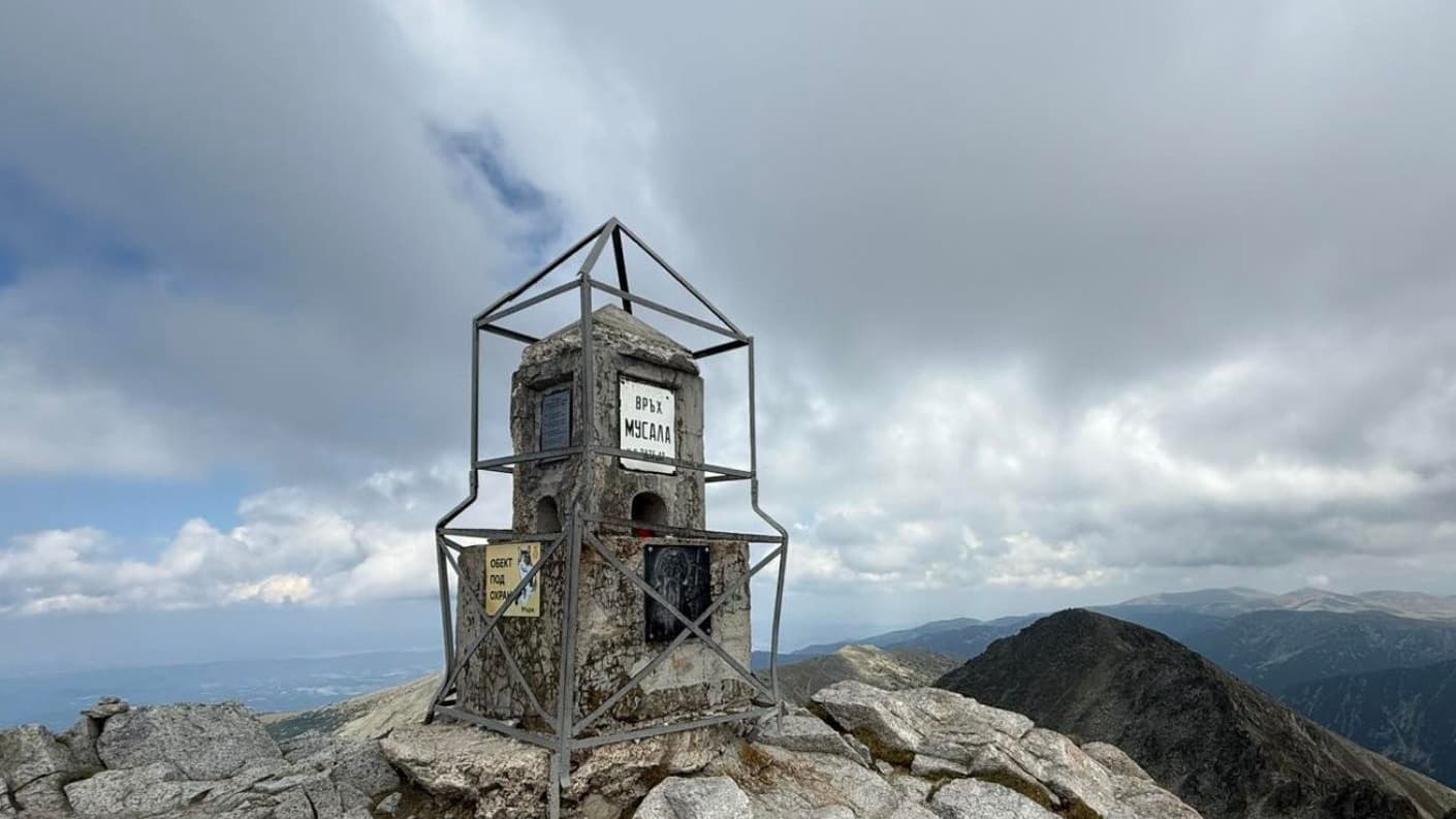
How to climb Musala (2,925 m), the highest peak in Bulgaria and the Balkans: the Borovets gondola, the route, huts, distances, season and what to pack.
Hiking the Seven Rila Lakes: Trail, Lift & Best Time
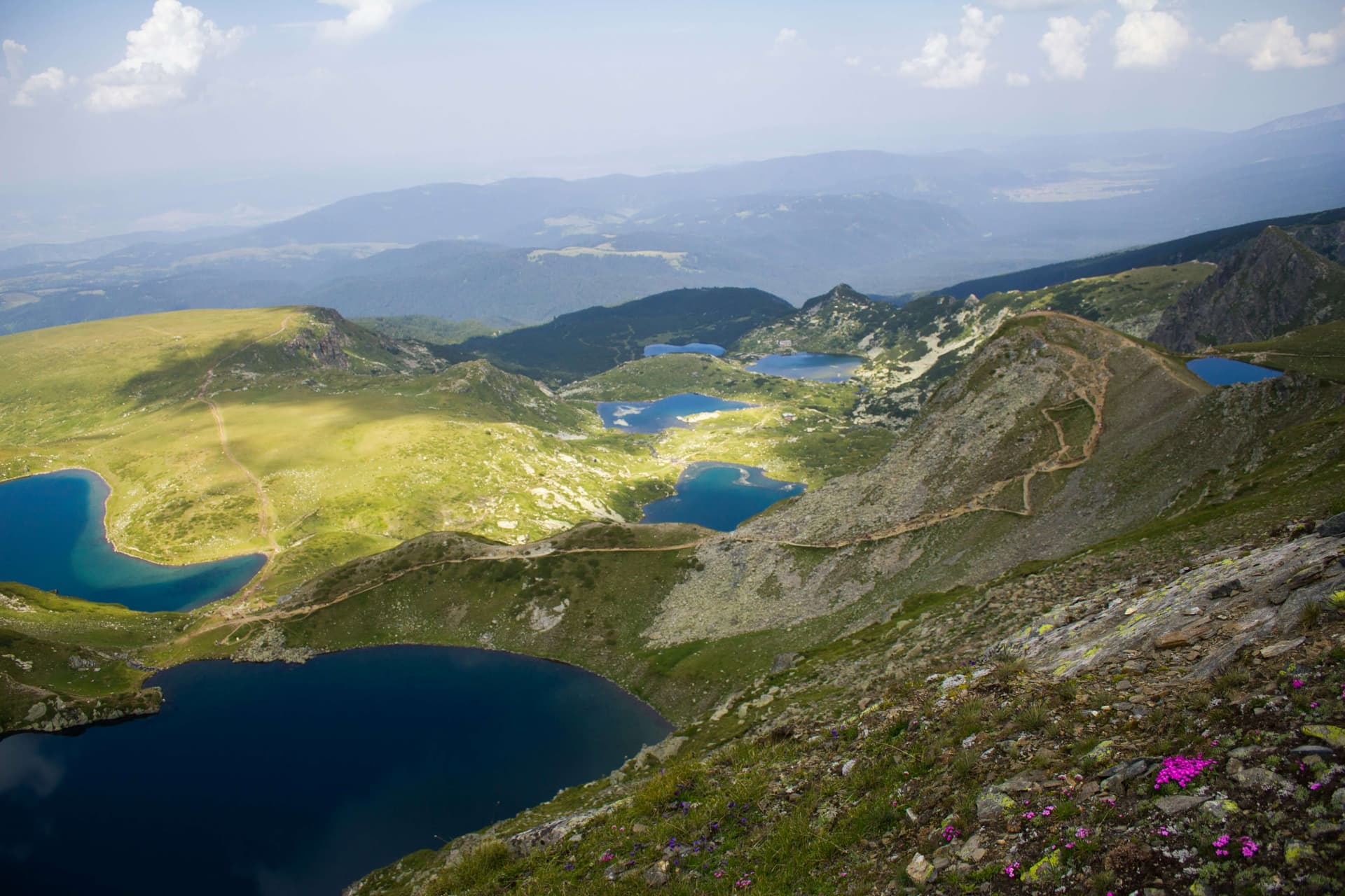
A complete guide to hiking the Seven Rila Lakes: the trailhead, chairlift prices and hours, the loop trail, parking, family tips, distances from Sofia, and where to stay.
Botev Peak & Raysko Praskalo: Hiking the Central Balkan
How to hike Botev Peak (2,376 m), the highest summit of the Balkan Mountains, from Kalofer — past Raysko Praskalo, the highest waterfall in the Balkans.