Kavarna is the administrative and economic centre of its municipality, set on the middle stretch of Bulgaria's northern Black Sea coast, south of Cape Kaliakra. National Statistical Institute figures put its population at 9,838 (31 December 2025).
Everything worth reaching is close: 18 km to Balchik, 20 km to Shabla, 42 km to Varna, 43 km to Dobrich, 38 km to Durankulak, and 500 km to Sofia.
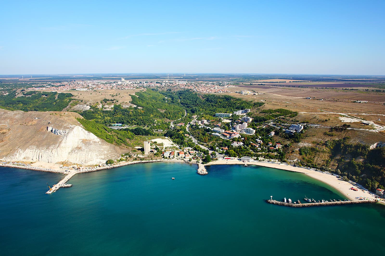
The terrain is flat to gently hilly, and the Kavarna coastline runs 42 kilometres — jagged, rocky and dotted with small beaches. A large artificial beach has also been built along the shore.
Above Kavarna rises Cape Chirakman, near-vertical and hard to reach. It once jutted kilometres out to sea, until a powerful earthquake tore away its leading edge. Erosion did the rest, shaping the sheer profile you see today.
Its flat plateau still holds the ruins of fortress walls, ditches, churches and necropolises, where archaeological excavations continue to this day.
This is where ancient Bizone stood. Founded in the 5th century BC by Greek colonists, the town played an important intermediary role in trade between local settlements and merchants from Rhodes, Heraclea, Sinope and Egypt. The northern Dobrudzha coast is awkward for mooring because of its cliffs, but one thing drew traders anyway: the high-quality wheat the local people grew and sold.
In the second half of the 1st century BC a catastrophic earthquake swallowed the ancient town. The front of Chirakman broke away, and Bizone's wealthiest residents went into the sea with it.
And that wasn't the only sinking. The underwater archaeological expedition "Kavarna '2005", led by Asen Salkin, located the boundaries of a submerged quarter of Roman Bizone in Kavarna Bay — dressed stone blocks and sections of brick wall dated to the 2nd century AD. According to the expedition, this quarter has nothing to do with the earthquake described by Strabo and Pomponius Mela. What it records is the movement of the land itself: the coast rose by roughly 4 metres between the 1st century BC and the 2nd century AD, then abruptly subsided, putting Bizone's shoreline districts underwater.
Rebuilt under Rome, the town flourished again under the same name. Remains survive of a 6th-century basilica, possibly dedicated to Saints Cosmas and Damian. The town lasted in this form until the 7th century, when it was destroyed by the Slavs and Bulgars, who founded the settlement of Karvuna.
In the Middle Ages it reached its height in the 13th–14th centuries, under the Dobrudzhan despots Balik and Dobrotitsa. Its present name is first recorded at the start of the 15th century.
Through the 15th to 19th centuries Kavarna was a Christian settlement and a grain port. From that period survive the hamam, a medieval necropolis, a bridge, fountains, churches and numerous inscriptions. Rich finds have been unearthed here — coins from many eras, gold jewellery, and a Thracian gold treasure of appliqués.
The Kavarna uprising, 1877. During the Russo-Turkish War of Liberation the townspeople took up arms against advancing bashi-bazouk and Circassian bands. A single telegram saved them.
The Armenian Eranos Eranosyan, head of the military telegraph in Balchik, sent an unauthorised telegram to the foreign consuls in Varna and the ambassadors in Constantinople: "At this moment the Christians in Kavarna are being slaughtered — half an hour's journey from Balchik. If no help arrives by tomorrow, all will be over." The diplomats acted at once with the Sublime Porte and forced the Ottoman authorities to send warships — having repeatedly refused the townspeople's own pleas. Eranosyan saved Kavarna but died defending it. In 2007, marking 130 years since the Liberation, the town unveiled a monument to him.
From 1913 the town was under Romanian occupation, returning to Bulgaria only in 1940. Throughout it, the Bulgarian population resisted assimilation through the church, the community centres and cultural societies.
The "Dobrudzha and the Sea" exhibition — a small maritime museum in the restored Ottoman bathhouse (the Hamam), built in the early 15th century: a solid domed stone structure at the head of the valley leading to the port, half a kilometre from the centre. On display are stone anchors, amphorae and ceramic vessels raised by underwater expeditions. The Treasury hall holds a unique polymetallic scroll — a pre-coinage medium of exchange — coins from many periods, and a Thracian gold treasure. Colour maps from antiquity and the Middle Ages round out the picture of early navigation.
The Town History Museum — right next to the Hamam. It covers the region's millennia of history: a model of a prehistoric cave settlement, tools, weapons and household objects, rifles and pistols from the wars of liberation, and ethnographic material.
The Ethnographic Museum — a handsome late-19th-century house that belonged to a wealthy family. Its interiors show the domestic life and culture of the region's three main groups: Dobrudzhans, Balkandzhii from Kotel, and Gagauz. The building is surrounded by a garden of mulberry trees, peonies and tulips.
The churches — St George (1836) and the Dormition of the Mother of God (1860). Both served as centres of education and culture under Ottoman rule and after the Liberation.
The old fountains — twelve spring-fed fountains spread along 2 km of the valley down to the port. Some are ruined, the rest restored. The spring water is abundant enough to form a small stream.
The water features in the town centre, between the post office and the community centre — a gathering place for locals.
Saglasie community centre — the oldest in the municipality, founded in 1890, with a library of around 68,200 volumes.
The town's speciality is "kateno meze", a dish born of the cooking of Aunt Katya, garrison cook to the 18th Infantry Regiment during the Balkan War years. Beyond it, the table is traditional northeastern Bulgarian.
Cape Kaliakra — jutting 2 km out to sea, 8 km from the village of Balgarevo. A nature and archaeological reserve. In the 4th century BC the settlement of Tirizis grew here, named after the Thracian Tirizi tribe. According to Strabo, Alexander the Great's governor Lysimachus stationed his army here and hid a treasure of forty loads of gold. Under Rome the fortress expanded as Akros Kastelum, gaining an aqueduct, baths, walls and public buildings. In the late 14th century Kaliakra became the capital of Dobrotitsa's Karvuna despotate, which minted coins bearing its name. The European shag nests on its cliffs, and dolphins are regularly seen from them.
Yaylata — a national archaeological reserve: a coastal terrace cut off from the Dobrudzha plateau by 50–60-metre rock walls. Here stands the cave settlement of over 100 caves dating to the 5th millennium BC. From antiquity survive a sanctuary, sacrificial stones, wine presses, four necropolises of rock-cut tombs carved into the cliff, and a partly restored 5th–6th century fortress. In the Middle Ages the caves served as a monastery complex — on some walls you can still make out Bulgar runes, crosses and stone icons.
Rusalka — a holiday village 20 km east of Kavarna, in the Bird Bay reserve north of Kaliakra. One of the few surviving stretches of wild steppe left in heavily urbanised Europe: a deeply indented rocky shore, sheltered pockets of sand, and centuries-old oaks. Archaeological remains here go back 8,000 years, and include ancient and medieval fortresses, rock tombs, caves and sacrificial stones.
The Kavarna region is one of Bulgaria's strongest destinations for birdwatching. The sheer diversity of species makes Kaliakra and Yaylata favourites with observers from around the world, and it works year-round — one of the continent's major migration flyways passes directly overhead.
Dolphins are seen in the coastal waters, and the area is rich in mineral water of table-water quality.
Summer is for the beach, but May–June and September are better for everything else: Kaliakra and Yaylata are far more pleasant to walk without the heat, the birds are in full migration, and the coast isn't crowded. If you're coming chiefly for the archaeology and the wildlife, pick a shoulder-season weekend.
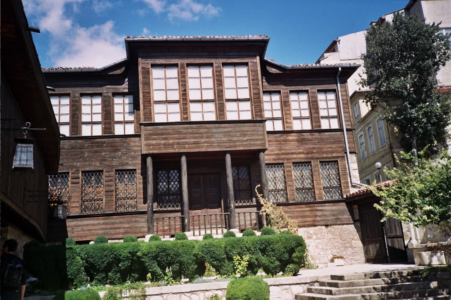
Dobrich region
0.5 km away
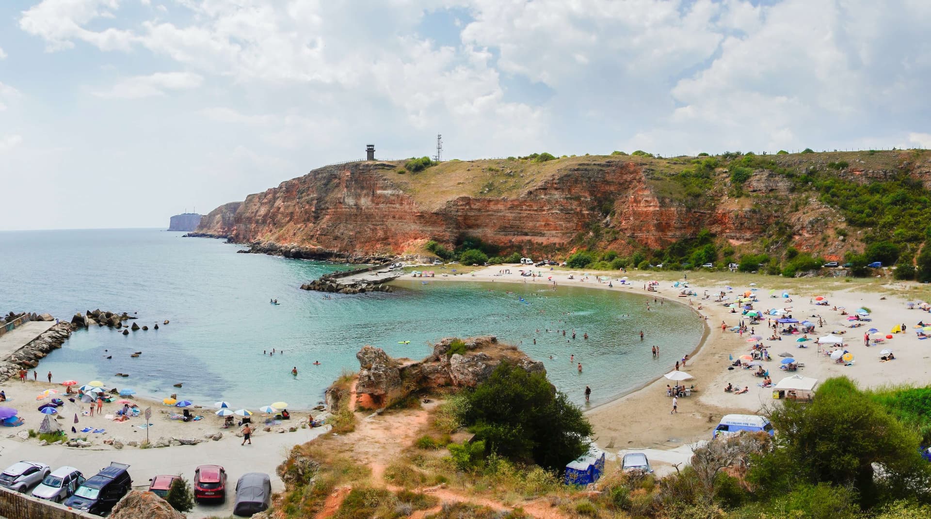
Dobrich region
12.0 km away
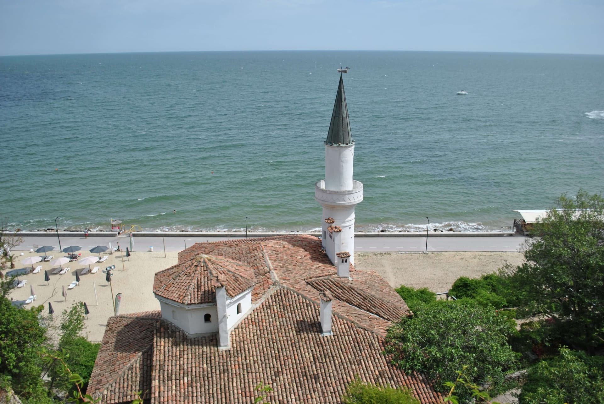
Discover Balchik: Queen Marie's Palace, the famous seaside Botanical Garden and cacti, ticket prices, parking tips, why the beach isn't here, and where to stay.
Bus 409 reaches central Varna in 20 minutes for about €1 and Golden Sands in 50. Zoned fares, the two operators to tell apart, and taxi costs.
Kavarna is located in Dobrich, Bulgaria.
Kavarna is most easily reached by car. Use the coordinates above to navigate, or open the location in OpenStreetMap or your preferred maps app for turn-by-turn directions. Public transport options vary by region — for remote destinations a rental car gives the most flexibility.
Kavarna can be visited year-round, but late spring (May–June) and early autumn (September–October) offer the most pleasant weather and fewer tourists. Summer is the busiest season; winter is the quietest, with shorter daylight and possible cold weather.
Bulgarian settlements typically reward unhurried walking — historic centres, churches and monasteries, local markets, and family-run restaurants serving regional dishes. Larger towns often have museums and seasonal cultural events. The local tourist information centre is a good first stop for current opening hours and what's on.