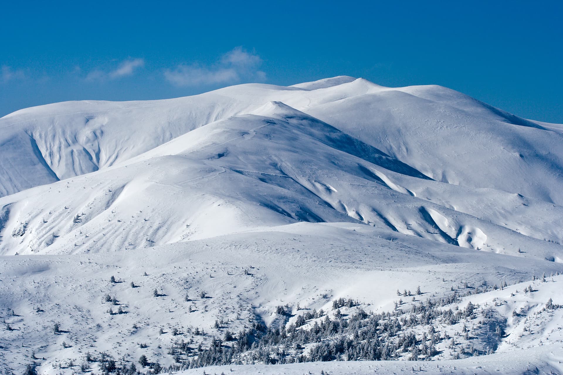
Mount Yosifitsa (2,697 m) is a massive granite dome towering within the Shishkovitsa region of Central Rila. It occupies a commanding position—flanked by the central Kanarata Peak to the southwest, the deep Ribni Ezera (Fish Lakes) cirque to the west, and Mount Venetsa to the southeast. Mostly barren and rocky, its lower northern slopes are guarded by dense belts of dwarf pine. Lacking official tourist trail markings, conquering Yosifitsa requires top-tier off-trail navigation skills and substantial mountaineering experience. Critical Safety Warning: This guide covers the summer route only under stable weather. The trail involves steep, technical, and exposed rocky terrain that becomes exceptionally hazardous, slippery, and avalanche-prone during rain, fog, or winter conditions. Route Essentials: - Starting Point: The mountain shelter/canton at Tiha Rila. - Distance: 7.1 km (one way). - Elevation Gain: (+) 697 meters. - Duration: Approximately 3 hours one way. - Difficulty: High (off-trail alpine route with scrambling sections). Approach Logistics The canton at Tiha Rila is accessible via a high-clearance 4x4 vehicle. If you hike without a motor vehicle, you must add the approach from Kirilova Polyana to Tiha Rila, which takes an additional 2 hours one way. Trail Breakdown: 1. Tiha Rila – The Old Sheepfold Meadow (~45 mins) The trek starts just before the Tiha Rila canton building. Take a faint, unmarked path heading north, immediately climbing through a pine forest. Within 5 minutes, the path veers east, wading through dwarf pine patches and crossing a few small streams. After 40 minutes, you will emerge onto a flat meadow with ruins of an old stone sheepfold. Here, your path intersects the official marked trail running between Ribni Ezera Hut and Kobilino Branishte. Ahead in the distance, the jagged silhouettes of the Zhandarmite and Mount Shishkovitsa are clearly visible. 2. Marinkovitsa River Valley – The Southeast Saddle (~1 hour 45 mins) Cross the intersection and head east into the pristine valley of the Marinkovitsa River. The faint track runs flat before turning sharply south. Mount Shishkovitsa and the craggy Venetsa Peak rise to your left, while the massive slope of Yosifitsa commands the right, sheltering one of the Marinkovitsa glacial lakes at its northeastern base. Hike through the grassy meadows, crossing a few streams where the trail fades entirely. From here, begin a steady, off-trail ascent southwest toward the prominent grassy saddle located southeast of Mount Yosifitsa. 3. The Summit Scramble (~30 mins) From the saddle, turn west and begin climbing the steep southeastern slopes of Yosifitsa. The grassy ground quickly shifts into loose granite blocks and steep slabs. In about 30 minutes, you will hit the southern base of the summit block. Follow a weak path up the rocky dome, navigating steep, exposed steps that require basic hands-on scrambling. The true summit (2,697 m) is marked by large stone cairns and rewards hikers with an expansive view of Rila's wild alpine core.

Sofia Province
2.2 km away
Sofia Province
2.4 km away
Kyustendil
2.6 km away
Kyustendil
3.2 km away
Yosifitsa is located in Kyustendil, Bulgaria.
Yosifitsa is most easily reached by car. Use the coordinates above to navigate, or open the location in OpenStreetMap or your preferred maps app for turn-by-turn directions. Public transport options vary by region — for remote destinations a rental car gives the most flexibility.
Late spring through early autumn (May–September) is best for Yosifitsa, when trails are clear of snow and weather is most stable. Higher peaks may hold snow into June and see fresh snow as early as October. Winter visits are for experienced mountaineers with proper gear.
Yosifitsa reaches an elevation of 2,697 metres above sea level.
Hiking boots, layered clothing, water (1.5–2 L per person), sun protection, and a windproof jacket — mountain weather changes quickly. For longer routes also bring a map (paper or offline), a head torch, and emergency rations. Tell someone your planned route and expected return time.