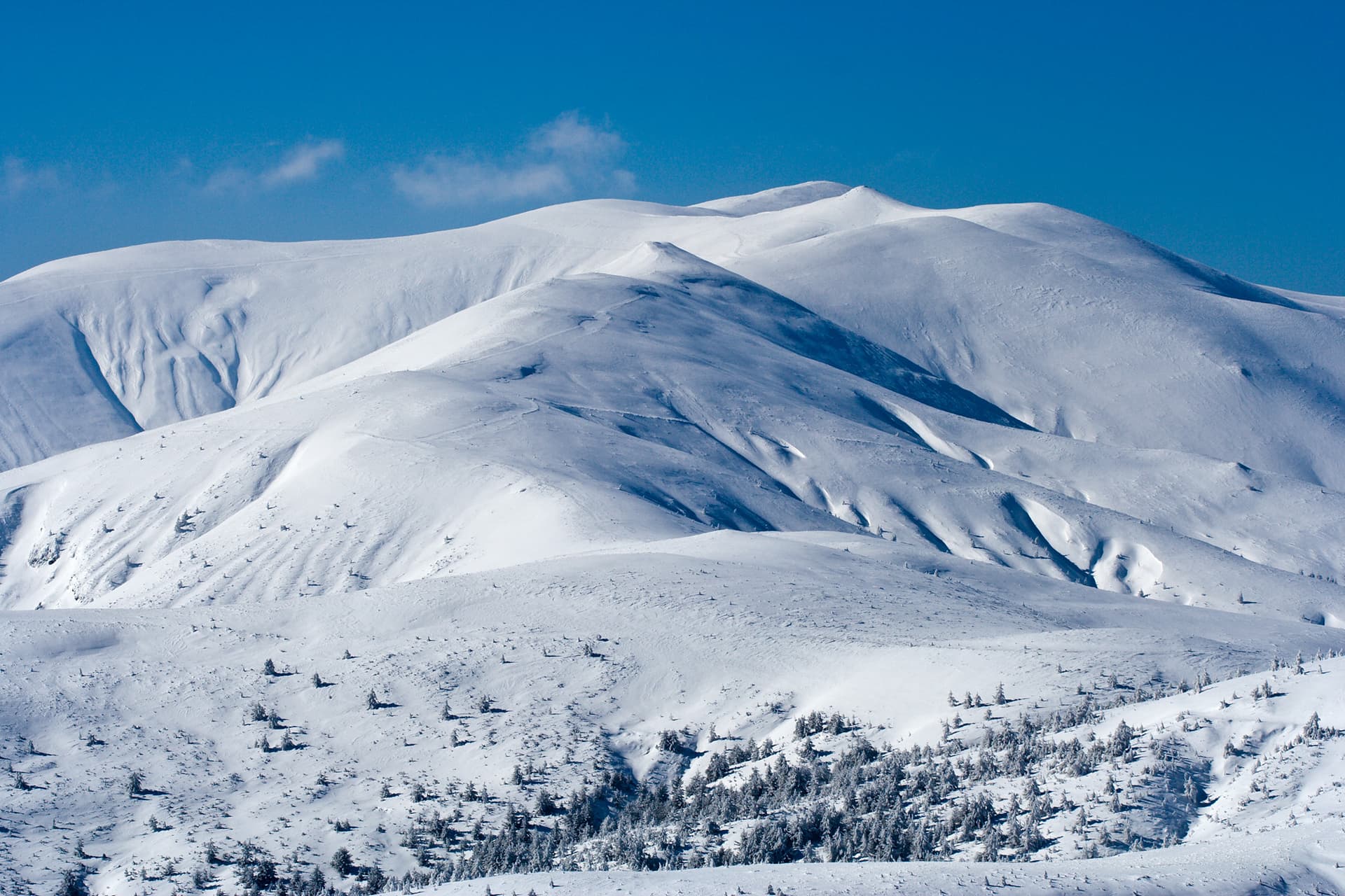
Mount Kriva Sospa is a scenic and panoramic peak in the Northwestern part of the Rila Mountains, attracting hikers who enjoy peaceful and secluded trails. It rises to the northwest of the massive Mount Kabul and directly west of the popular Skakavitsa Mountain Hut. Kriva Sospa is covered almost entirely by lush green meadows, with scattered patches of dense juniper bushes. The Goritsa River originates from its eastern foothills, wrapping around the mountain massif from the north and serving as a key navigation landmark for trekkers. The southern slopes of the peak descend into the beautiful valley of the Otovitsa River (a left tributary of the Dzherman River). To the southeast of Kriva Sospa, the mountain ridge gradually gains elevation until it merges with the highest point of this specific area, Mount Kabul. Trail Features and Safety Advice The primary starting point for this mountain route is the well-known Zeleni Preslap area. It is important to note that the final ascent up the northeastern slope of the peak is done entirely off-trail, without any markers or designated paths, requiring navigation based purely on terrain features. Due to the broad and wide nature of the slope, extra caution is needed during fog or poor visibility to avoid delays. Alternatively, Kriva Sospa can be easily summited from its southeastern neighbor, Mount Kabul. Key Trail Parameters: - Starting Point: The parking lot in the Zeleni Preslap area. - Total Distance: 5.2 km. - Elevation Gain: 790 meters. - Duration: Approximately 3 hours one way. - Warning: This is strictly a summer route! Detailed Step-by-Step Hiking Route Description Stage 1: From Zeleni Preslap to the Forest Line The trek begins at the parking lot in Zeleni Preslap. While the wide main road heading south leads toward Skakavitsa Hut, you must turn right near the information boards to follow a clearly defined forest path. Enter a beautiful forest with mixed vegetation. Initially, head southwest, but after about 5 minutes, the path turns left, guiding you directly south. Walk for about 15 minutes at a moderate incline, after which the trail transitions into a steep uphill climb, zigzagging eastward through the woods. After about an hour of hiking, you will exit the forest line and enter the dwarf shrub zone. Stage 2: Through the Perushtitsa Valley to the Tashmandra Saddle The trail continues high along the right slope of the Perushtitsa River valley, where the incline gradually decreases, making the walk much easier. About 30 minutes after leaving the forest, you will pass near an authentic shepherd hut with a distinctive stone fence, located on the opposite side of the river, whose springs are located in this area. Following the path, make a left turn to the south. After another 10 minutes, you will reach the saddle located southeast of Tashmandra Peak, which is a major trail junction. A stone shaft on your left serves as an excellent landmark. Here, the paths split for three different summits: turning right off-trail leads up the southeastern slope of Tashmandra Peak, while continuing southeast along the main ridge path leads to Mount Kabul. Stage 3: Along the Goritsa River to the Summit of Kriva Sospa To reach Kriva Sospa, follow the main path toward Kabul initially, but soon branch off to the right along a faint, improvised trail. The goal is to track the winding course of the Goritsa River, walking parallel to the Kabul trail but remaining directly on the right bank of the river stream. After about ten minutes, you will reach the crossing point of the Goritsa River, marking the start of the final ascent up the northeastern slope of Kriva Sospa. From this point forward, walk entirely off-trail in a southwesterly direction, navigating through grassy slopes and juniper patches. After about 20 minutes, you will emerge onto a flat plateau. The flat walk is short, followed immediately by the final uphill push. The summit of Mount Kriva Sospa is reached after another 40 minutes, opening up into a wide, flat, and highly panoramic meadow marked by a stone cairn.

Kyustendil
1.7 km away
Kyustendil
2.6 km away
Kyustendil
2.9 km away
Kriva sospa is located in Kyustendil, Bulgaria.
Kriva sospa is most easily reached by car. Use the coordinates above to navigate, or open the location in OpenStreetMap or your preferred maps app for turn-by-turn directions. Public transport options vary by region — for remote destinations a rental car gives the most flexibility.
Late spring through early autumn (May–September) is best for Kriva sospa, when trails are clear of snow and weather is most stable. Higher peaks may hold snow into June and see fresh snow as early as October. Winter visits are for experienced mountaineers with proper gear.
Kriva sospa reaches an elevation of 2,390 metres above sea level.
Hiking boots, layered clothing, water (1.5–2 L per person), sun protection, and a windproof jacket — mountain weather changes quickly. For longer routes also bring a map (paper or offline), a head torch, and emergency rations. Tell someone your planned route and expected return time.