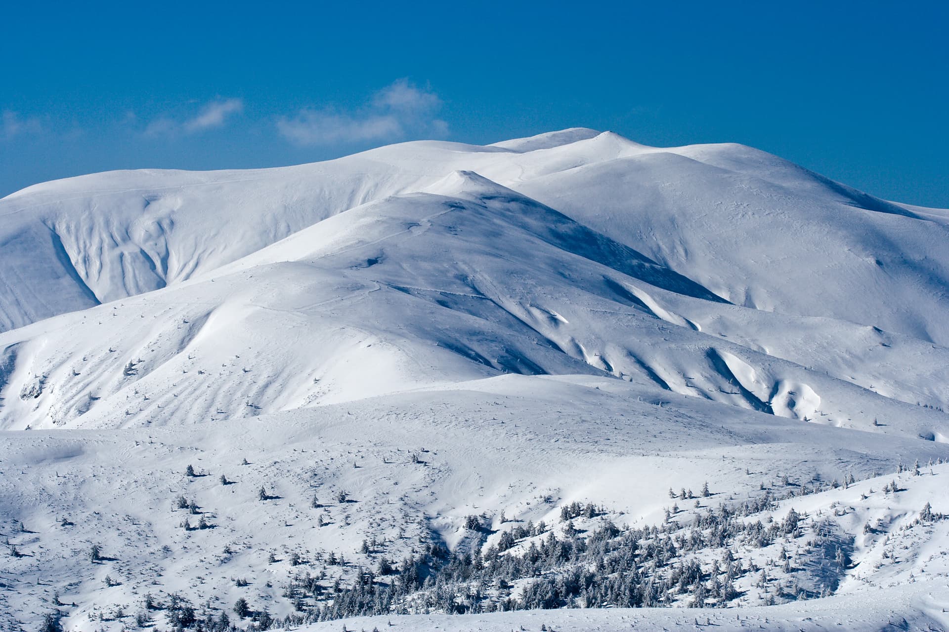
Mount Golyam Mermer is one of the most panoramic and majestic peaks in the Northwestern part of the Rila Mountains. Located southwest of the iconic Mount Malovitsa, west of Elenin Peak, and east of the lower Malak Mermer, it attracts experienced hikers with its rugged topography. The massif of Golyam Mermer features a mix of grassy and rocky terrain, but its eastern slopes are particularly dramatic, descending into almost completely vertical, imposing rock walls. From the southern side of the peak stretches the famous Dalgia Rid (The Long Ridge), which runs all the way down to the Rila Monastery and the scenic valley of the Manastirska River. To the north, the peak transitions into a gentler, mostly grassy slope, while to the west, a well-defined saddle separates it from its neighbor, Malak Mermer. Important Information and Safety This high-mountain hiking route is strictly suitable for the summer season. It is crucial to note that during winter and whenever snow cover is present, the entire Malovitsa River valley becomes highly avalanche-prone. Under winter conditions, attempting to summit the peak via this route is extremely dangerous and strictly discouraged. The trek is physically demanding and long, so it should only be undertaken during long summer days with a stable weather forecast. Key Trail Parameters: - Starting Point: Central Mountain School (CPS) Malovitsa. - Total Distance: 7.7 km. - Elevation Gain: 881 meters. - Duration: Approximately 3 hours and 50 minutes one way. - Detailed Step-by-Step Hiking Route Description Stage 1: From CPS Malovitsa to Malovitsa Hut The adventure begins at Mecha Polyana (Bear Meadow) in front of CPS Malovitsa, the main hub for hiking in this region of Rila. Head south along the trail, entering the territory of Rila National Park shortly after. Follow the blue tourist trail markings along the right bank of the Malovitsa River, gradually gaining elevation. In just under 2 km (about 35 minutes), cross the river via a stone bridge, right next to a natural drinking fountain. From this point, continue along the left bank for another 15 minutes to reach Malovitsa Hut. The entire walk from the start to the hut takes less than an hour. Stage 2: From Malovitsa Hut through the First and Second Terraces From the mountain hut, continue south, entering a dwarf scrub pine zone along a well-cleared path. Here, the red trail markings join the route, which you will eventually follow along the main ridge. After about 10 minutes, cross the river again by stepping over exposed rocks. Be careful during high-water periods, as you might need to step into the water. The path then starts climbing more steeply, leading up to a flat, grassy meadow known as the First Terrace (Parva Terasa). After a short flat walk, the trail climbs again and crosses the Malovitsa River once more to reach the Second Terrace (Vtora Terasa), marked by a large rock face dedicated to fallen climbers. This stage from the hut takes about 50 minutes. Stage 3: Climbing Past Elenino Lake to the Malovitsa Ridge At the Second Terrace, the blue trail markings split to the left towards the BAK shelter, while our route keeps heading south along the red markings, tracking upstream. After about 5 minutes, cross one of the tributaries of the Malovitsa River and immediately begin a steep, rocky zigzag climb to the right. Following the path closely for about 50 minutes will bring you to the educational signpost at the shores of Elenino Lake, the largest lake in the cirque. From the lake, head south and southwest, climbing steeply up a rocky path. After another 35 minutes, you will emerge onto the main ridge saddle between Elenin Peak and Mount Malovitsa, marked by a stone cairn and a winter trail pole. Stage 4: Along the Ridge and the Final Ascent to Golyam Mermer At the ridge saddle, turn right and follow the main trail along the ridge crest. You will need to scramble over a few rocky sections, which can be slippery when wet and require extra caution. Within 10 minutes, you will arrive at the southern foothills of Mount Malovitsa (which you can summit via a short detour to the right). To reach Golyam Mermer, however, keep heading straight west across a grassy plateau, following the winter stakes. After about 20 minutes of descending, the terrain flattens out, and the trail begins to bypass the northern slopes of Golyam Mermer. Navigate a short rocky section and begin climbing once more. A few minutes later, you will reach a crucial junction: the official marked trail continues straight toward the Razdela area and Ivan Vazov Hut, but you must leave the main path and turn left. Head straight up the grassy-rocky slope without a designated trail. The highest point of Golyam Mermer is reached within a few minutes. Warning: The summit is not clearly marked. In case of fog or poor visibility, exercise extreme caution, as the ground drops off into a dangerous vertical abyss immediately past the highest point on its eastern side!

Kyustendil
0.7 km away

Sofia Province
1.1 km away
Kyustendil
1.3 km away
Sofia Province
1.5 km away
Golyam Mermer is located in Kyustendil, Bulgaria.
Golyam Mermer is most easily reached by car. Use the coordinates above to navigate, or open the location in OpenStreetMap or your preferred maps app for turn-by-turn directions. Public transport options vary by region — for remote destinations a rental car gives the most flexibility.
Late spring through early autumn (May–September) is best for Golyam Mermer, when trails are clear of snow and weather is most stable. Higher peaks may hold snow into June and see fresh snow as early as October. Winter visits are for experienced mountaineers with proper gear.
Golyam Mermer reaches an elevation of 2,589 metres above sea level.
Hiking boots, layered clothing, water (1.5–2 L per person), sun protection, and a windproof jacket — mountain weather changes quickly. For longer routes also bring a map (paper or offline), a head torch, and emergency rations. Tell someone your planned route and expected return time.