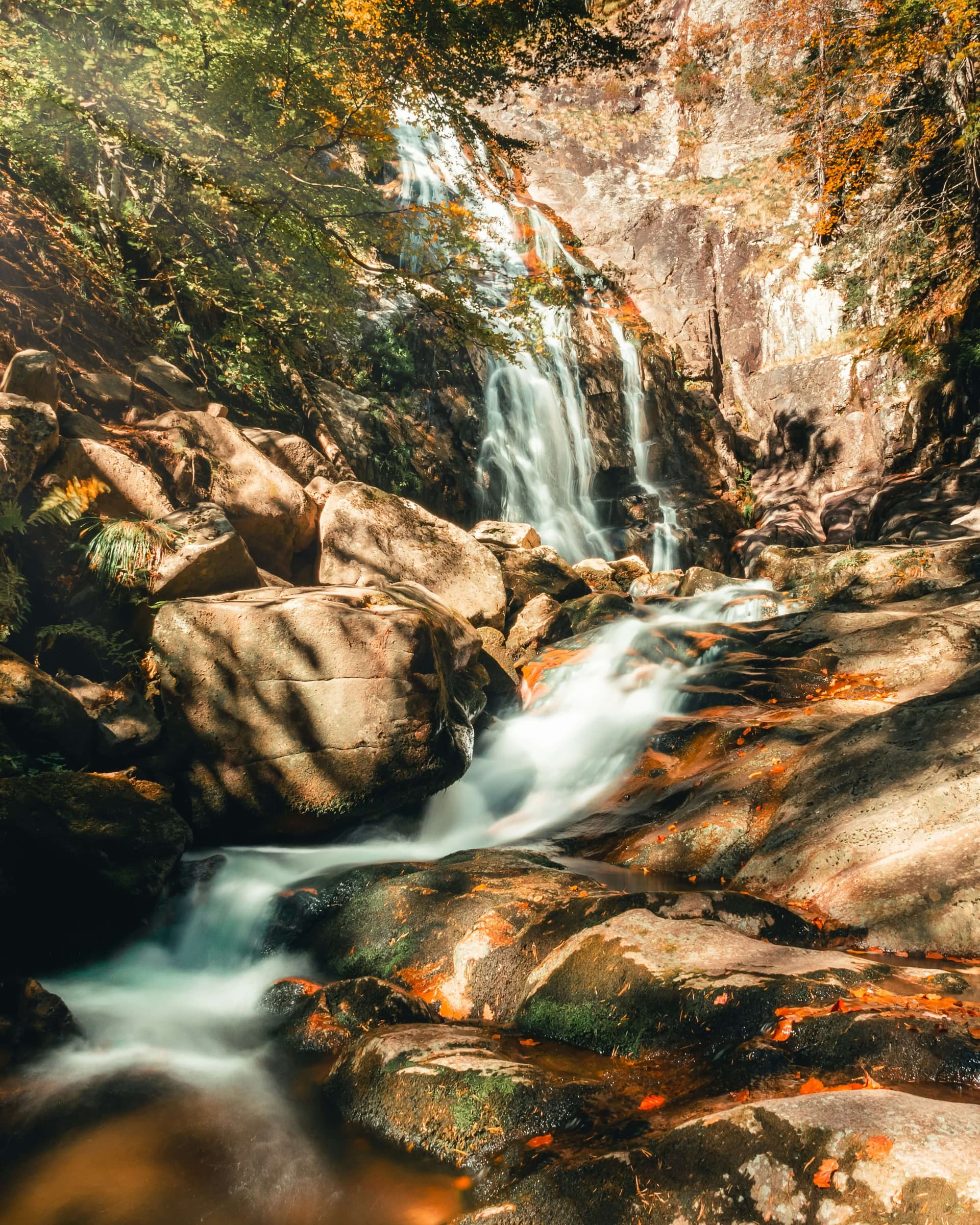
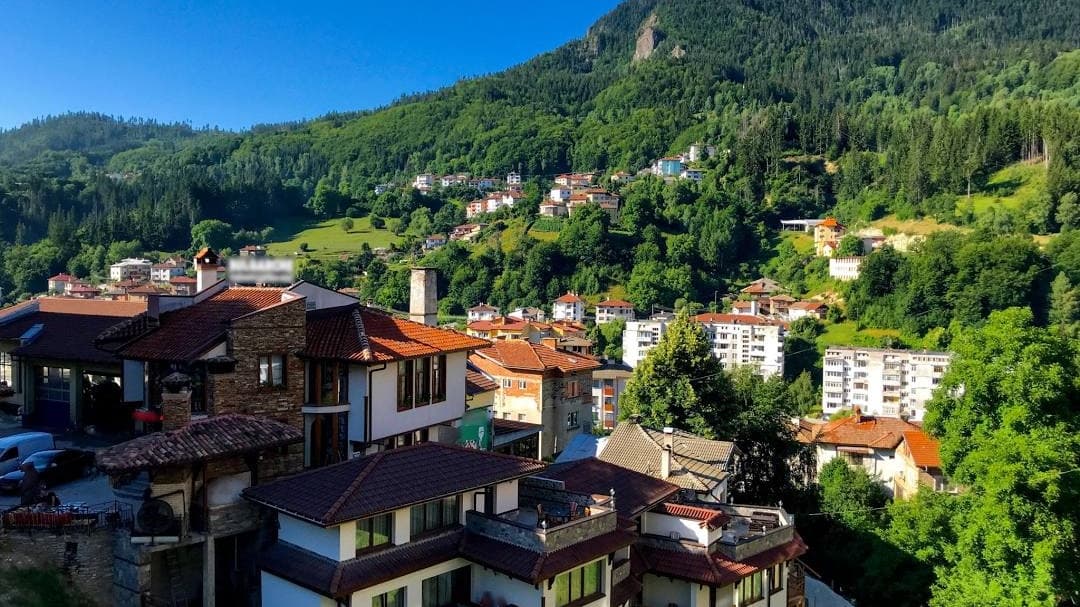
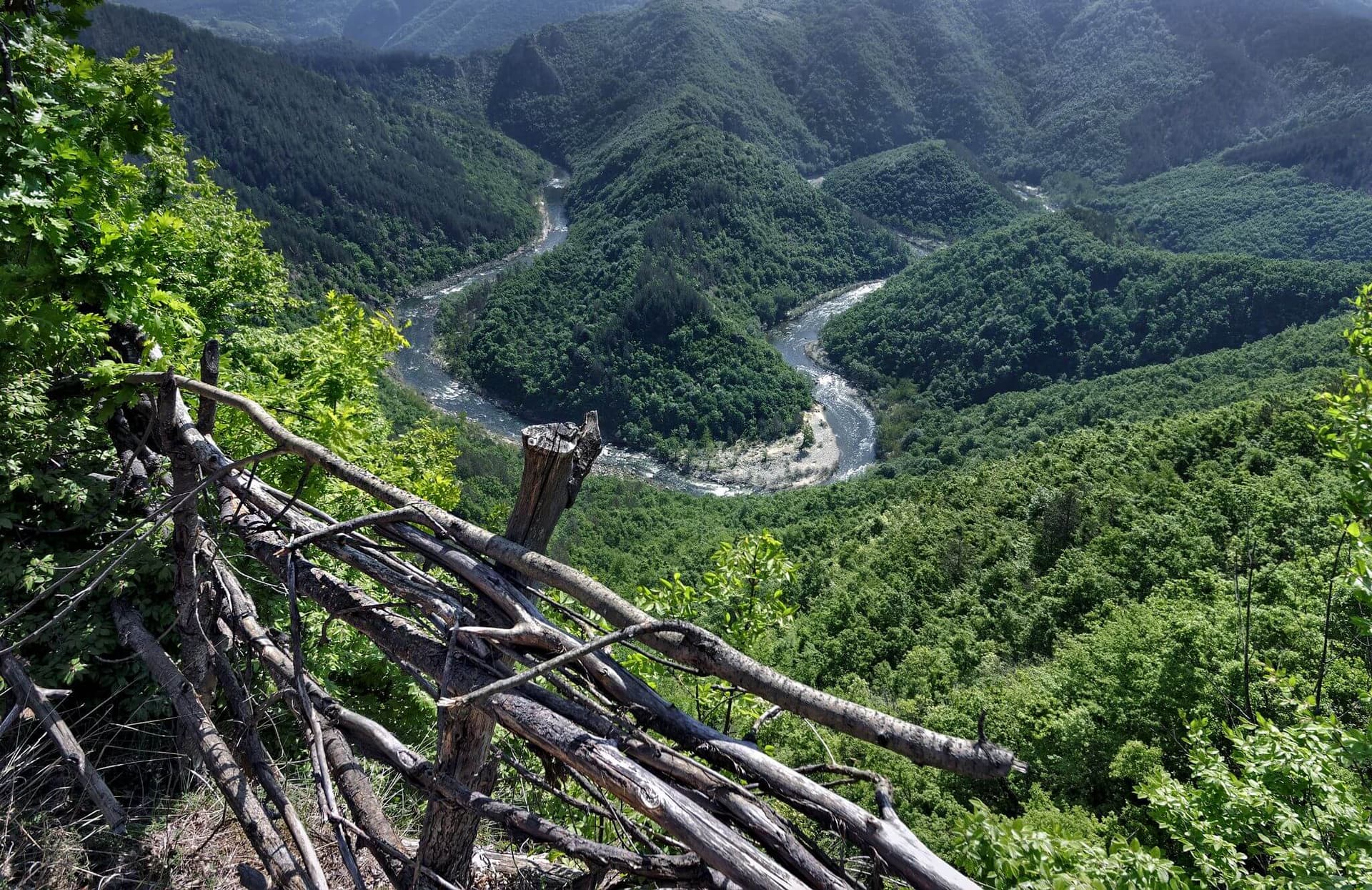
The Canyon of Waterfalls Eco-Trail stands as one of the most picturesque, extensive, and widely popular destinations for hiking and ecological tourism across Southern Bulgaria. The destination positions in immediate proximity to the mountain town of Smolyan, winding within the core of the scenic and strictly protected Soskovcheto Reserve. The itinerary is mapped entirely along the gorge of the Gerzovska River, whose dynamic water flow has sculpted dozens of large and small waterfalls, giving the official title to this mountain path. The alluvial terraces and high rock crests offer perfect parameters for an escape into pure wilderness in the heart of the Rhodopes. Principal Natural Phenomena and Panoramic Viewpoints The eco-trail itinerary is densely saturated with impressive water cascades and geomorphological structures, highlighted by: - Orpheus Waterfall: Boasts an impressive vertical drop measuring 68 meters, ranking it among the highest waterfalls across the Rhodope Mountains. Its water columns descend brilliantly down a massive gray cliff face, whose natural symmetry strikingly mirrors an ancient lyre. - The Heart Waterfall (Sartseto): An exceptionally interesting karst waterfall whose waters split into two symmetrical streams, forming a perfect heart contour within the rocky riverbed. - Panoramic Platforms: Built along the elevated sectors are three specialized observation platforms that offer hikers breathtaking panoramic views overlooking the canyon, ancient coniferous forests, and the roofs of the town of Smolyan. Geographical Location and Logistical Travel Directions To access the perimeter of the eco-trail, travelers must drive from the town of Smolyan toward the high-altitude village of Mugla. Shortly after exiting the outskirts of Smolyan, near an old concrete mixing facility, the route branches to the right along a narrow scenic road with weathered asphalt. Operating as a clear marker at this junction are permanent yellow arrows and directional signs marking the eco-trail. Visitors can drive forward until reaching a small designated parking area. It is highly recommended to leave vehicles at this lot, as the road surface transitions into a heavily broken mountain cart track, and the actual trailhead positions immediate to this spot. Technical Specifications and the Four Phases of the Loop Itinerary The primary hiking itinerary of the eco-trail structures as a closed loop and takes approximately 3 hours of steady walking to complete, excluding regular stops for photography and resting. The entire trail is excellently marked with signs and blazes, equipped with comfortable wooden resting zones, bridges, and stairs. Distribution of the Hiking Trek Across Technical Phases: - Phase 1 (Parking - First Bridge): Comprises a gentle and steady ascent along a wide road whose surface is partially covered with old asphalt. This initial phase takes about 35 minutes to complete, terminating upon reaching the first massive bridge spanning the Gerzovska River. This bridge operates as a pivotal point, as the entire loop itinerary closes around it upon return. - Phase 2 (First Bridge - First Panoramic Platform): From the bridge, the trail tracks slightly to the right and upward, entering the canyon proper. Depending on preceding weather conditions and windfalls, fallen logs may be observed within the riverbed, but the hiking track is regularly cleared, and the stairs and bridges are maintained in solid condition. This phase is steeper, requiring ascents via wooden stairs and traversing numerous footbridges spanning the river. Positioned here are the two most attractive waterfalls - Orpheus and The Heart. The phase takes roughly 60 minutes, terminating at the first major panoramic platform high within the cliffs. - Phase 3 (First Panoramic Platform - First Bridge): At the absolute opening of this section, the trail climbs slightly further to its maximum altitude, after which a gradual descent launches, shifting into steep and slippery segments across sectors. The path winds inside a beautiful shaded forest, passing sequentially through the second panoramic platform and a third platform positioned slightly off the primary track. This trek takes about 50 minutes, guiding hikers back to the first bridge. - Phase 4 (First Bridge - Parking): Replicates Phase 1 entirely but in the reverse direction, with the descent along the broken road taking exactly 35 minutes. The Urban Smolyan Waterfall Operating as an excellent alternative and complement to the trek, the Smolyan Waterfall can be visited right within the outskirts of the town. It commands a unique status, ranking as one of the few purely urban waterfalls across the territory of Bulgaria. Its water volume pours grandly from a massive, high rock crest positioned immediate to residential houses within the southwestern edges of Smolyan, very close to a busy primary street. Logistical Instructions for the Smolyan Waterfall: - Navigation: Travel along the highway leading toward Mugla village and the Canyon of Waterfalls. The pedestrian trailhead branching off the street anchors at the following precise geographical coordinates: latitude 41.581445 north and longitude 24.677216 east. - Hiking Route: At this spot, the trail detaches to the right side of the street, marked by an information board. The itinerary tracks upward along a short concrete path, reaching a wooden gazebo, after which it turns slightly to the left. Following only a few meters, hikers step directly in front of the baseline of the waterfall.

Smolyan
1.0 km away

Smolyan
5.1 km away
Smolyan
5.9 km away
Everything you need to plan a Rhodope Mountains trip: Smolyan, Pamporovo, Trigrad Gorge, Shiroka Laka, Perperikon, caves, spa towns, food, itineraries and when to go.
A travel guide to Smolyan, the highest town in Bulgaria: the Smolyan Lakes, the planetarium, the Canyon of Waterfalls, day trips to Pamporovo, Shiroka Laka and the Trigrad caves.
Looking for off-the-beaten-path destinations? Discover the 10 most magical hidden gems in Bulgaria—from the Womb Cave and Prohodna to Emen Canyon and Kosti.
Canyon of Waterfalls near Smolyan is located in Smolyan, Bulgaria.
Canyon of Waterfalls near Smolyan is most easily reached by car. Use the coordinates above to navigate, or open the location in OpenStreetMap or your preferred maps app for turn-by-turn directions. Public transport options vary by region — for remote destinations a rental car gives the most flexibility.
Canyon of Waterfalls near Smolyan is best walked from May through October, when the trail is clear of snow and weather is generally stable. Summer middays can be hot at lower altitudes — start early. Winter walking requires proper gear and route knowledge.
Suitability depends on the specific route. Bulgarian trails range from paved family-friendly paths to multi-day high-mountain crossings. Check the length, elevation gain, and surface before setting off. Sturdy footwear, water, and a basic map (offline or paper) are essential even on short walks.