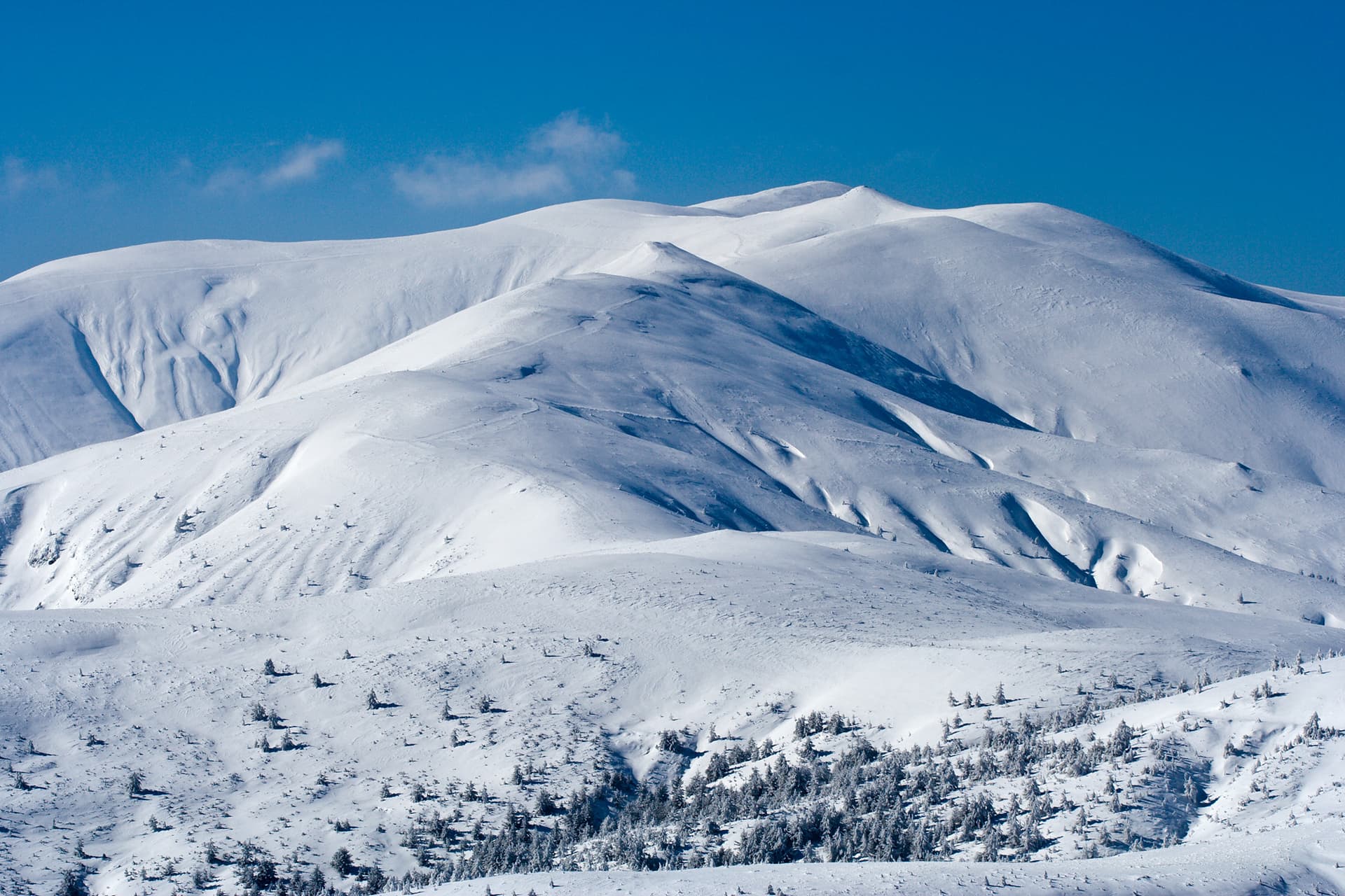
Zhaltets Peak (2,226.8 m), also known by its ancient name Sarukaya, is one of the majestic sentinels of the Central Balkan Mountains. Located on the main ridge within the Kalofer range, it is a key part of the most thrilling alpine traverse in Bulgaria—the route between Dobrila Hut and Botev Peak. With its grassy summit and vertiginous northern cliffs, Zhaltets offers hikers the raw beauty of the high mountains and views that linger in the soul forever. Natural Phenomena and Terrain - The Brustovete Ridge: Branching northwest from the peak is the imposing Brustovete rocky ridge. It consists of a series of vertical rock towers (gendarmes) that give the mountain a true alpine character. - Markovi Otkosi: On the northern slopes lies the unique natural phenomenon "Markovi Otkosi" (Marko's Mows)—massive rock steps that local folklore says were carved by the legendary hero Krali Marko. - The Polenitsi Areas: Golemi and Malki Polenitsi are vast high-mountain pastures that soften the peak's rugged profile, traditionally used for summer grazing. Alpinism and Challenges - Alpine Traverse: For climbers, Zhaltets is a serious challenge. Traversing the peak involves a Grade IV 'b' difficulty level, requiring specific skills and mountaineering equipment. - Winter Hazards: During the winter, the peak transforms and becomes extremely dangerous. Due to its steep western and northern slopes, the area is highly avalanche-prone and is not recommended for passage during the snowy season. Tourism and Panoramas - Kom-Emine Trail: Zhaltets Peak is a vital point on the international E3 long-distance trail. Crossing the summit in clear weather rewards hikers with breathtaking panoramas of both Northern and Southern Bulgaria simultaneously. - Location: As a central part of the ridge between Dobrila and Botev, the peak is a favorite spot for experienced mountaineers seeking the authentic face of the Balkan Range.

Lovech
1.1 km away
Plovdiv
1.7 km away
Lovech
3.1 km away
Plovdiv
3.4 km away
Zhaltets is located in Lovech, Bulgaria.
Zhaltets is most easily reached by car. Use the coordinates above to navigate, or open the location in OpenStreetMap or your preferred maps app for turn-by-turn directions. Public transport options vary by region — for remote destinations a rental car gives the most flexibility.
Late spring through early autumn (May–September) is best for Zhaltets, when trails are clear of snow and weather is most stable. Higher peaks may hold snow into June and see fresh snow as early as October. Winter visits are for experienced mountaineers with proper gear.
Zhaltets reaches an elevation of 2,226 metres above sea level.
Hiking boots, layered clothing, water (1.5–2 L per person), sun protection, and a windproof jacket — mountain weather changes quickly. For longer routes also bring a map (paper or offline), a head torch, and emergency rations. Tell someone your planned route and expected return time.