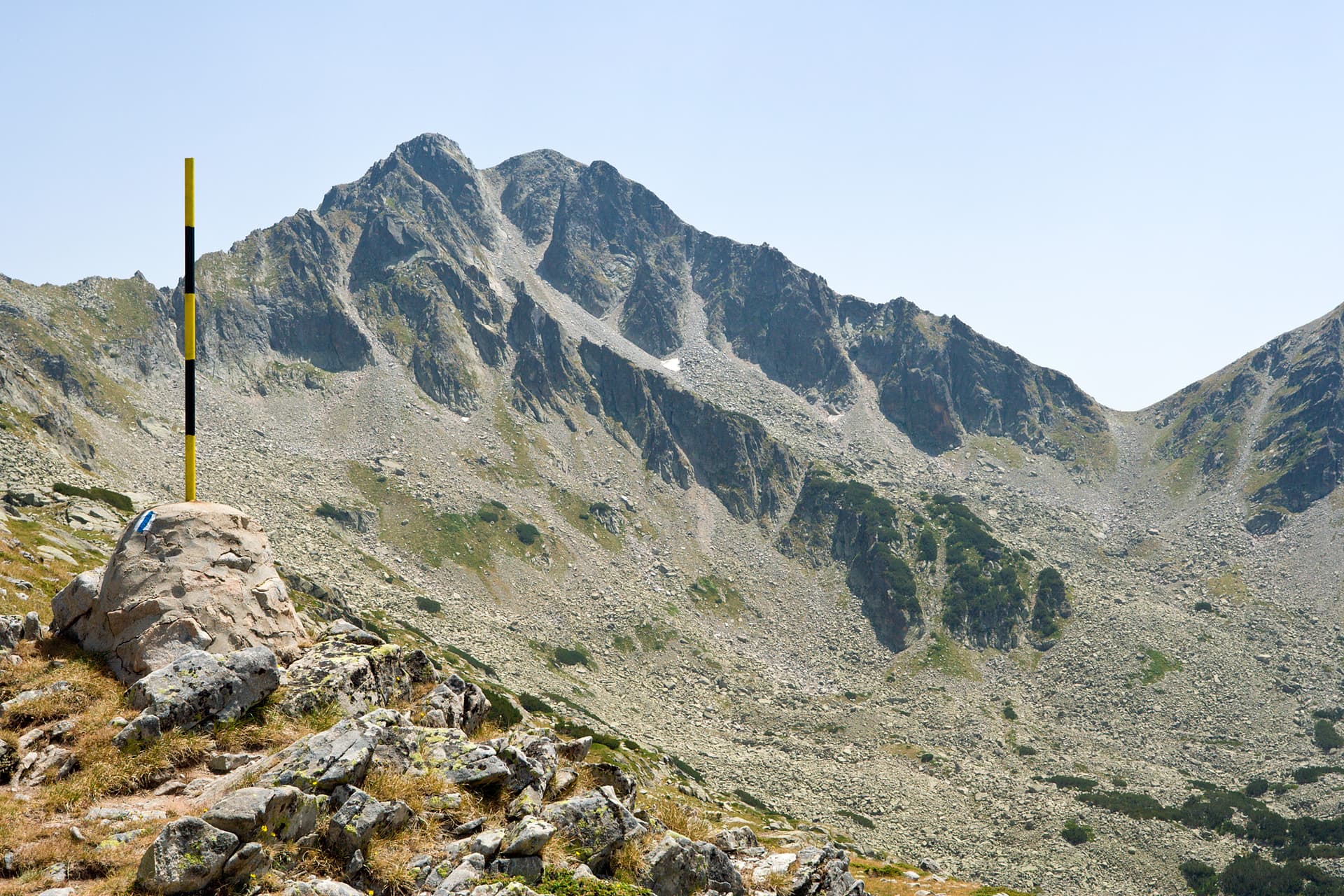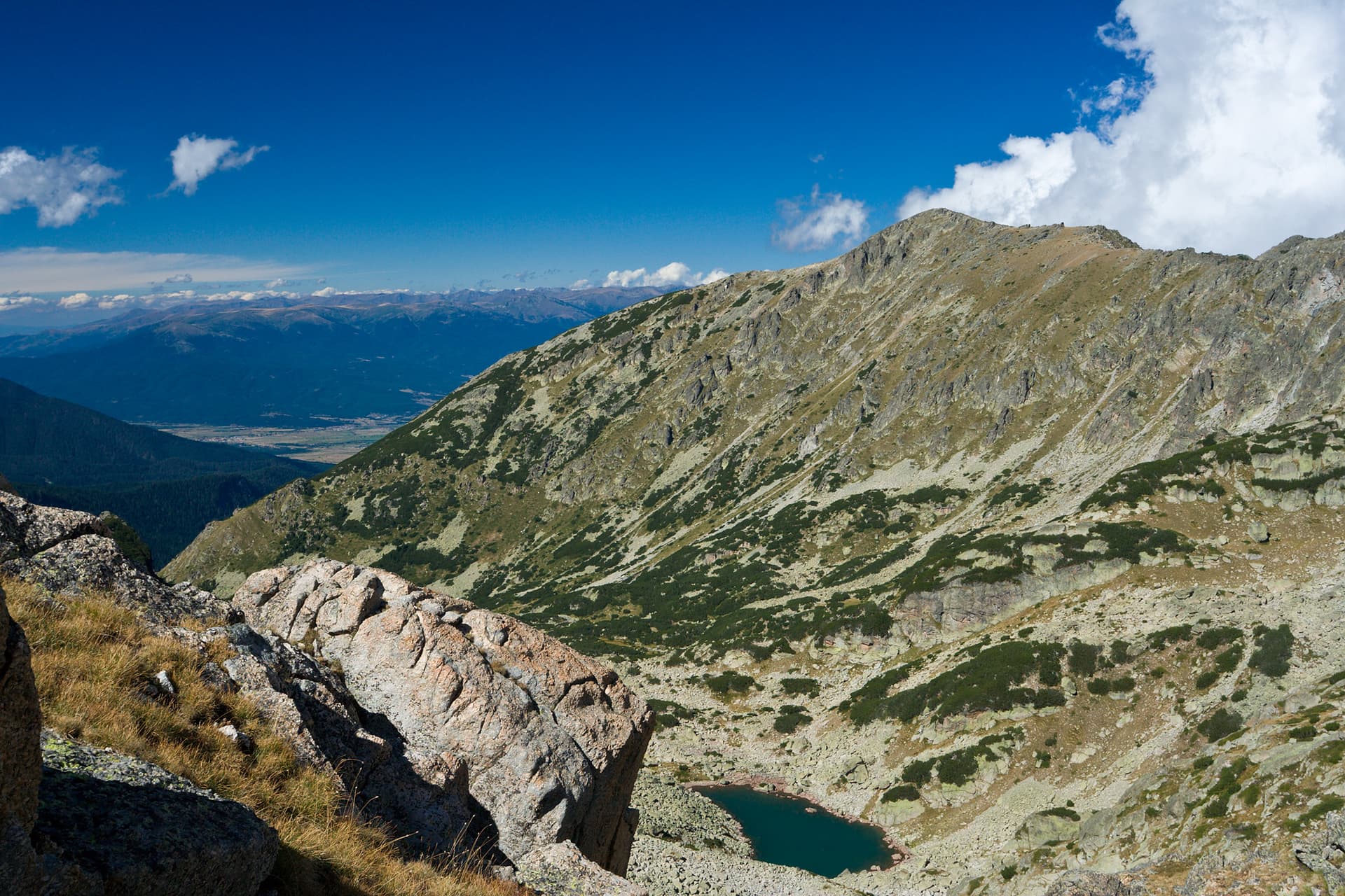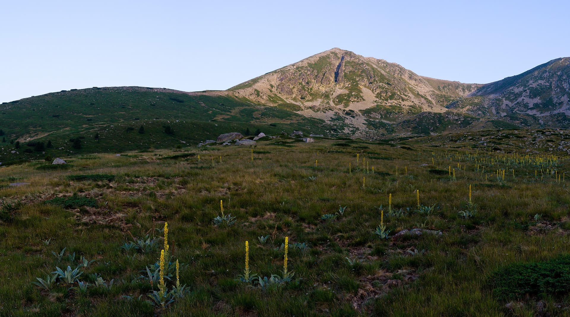
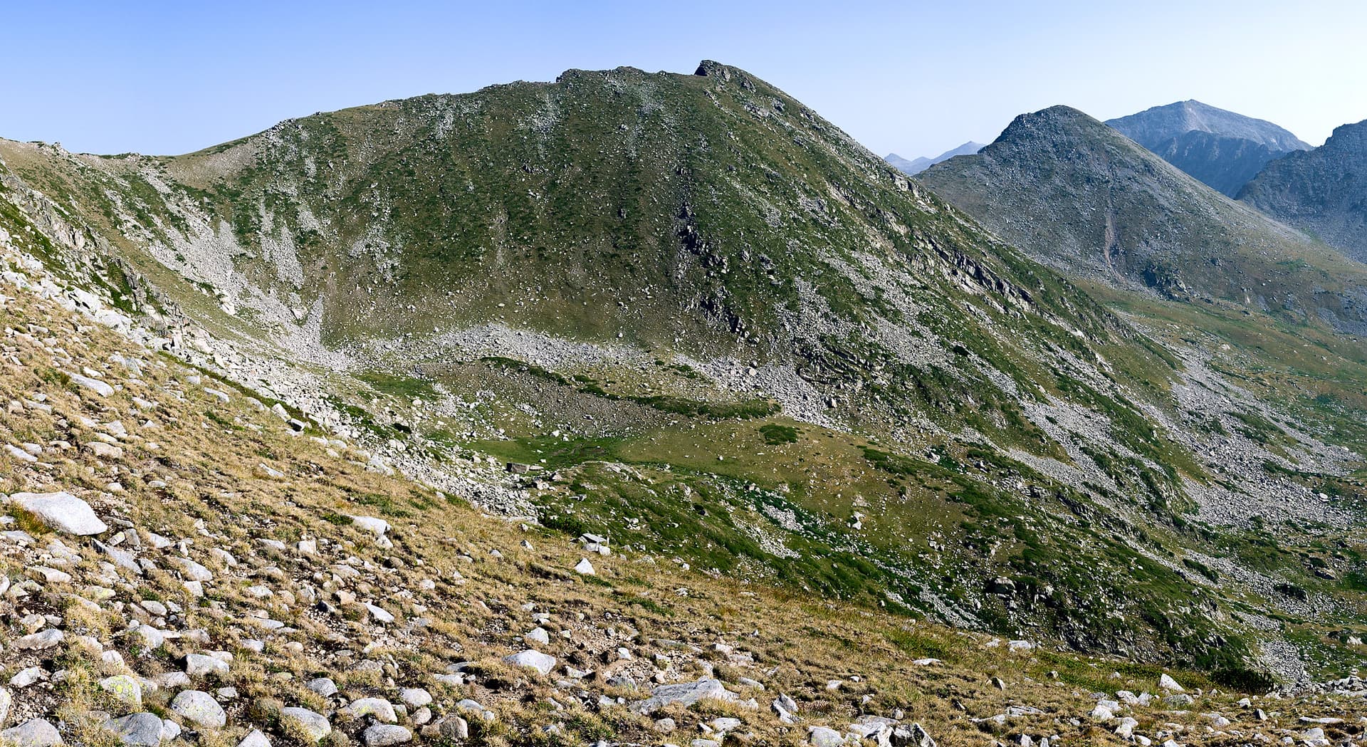
Golena Peak (2633 m) is an impressive granite summit located in the Northern section of the Pirin Mountains. It sits on a ridge branching southeast from the Kamenitsa side ridge near the Solishteto area. The peak is characterized by its contrasting slopes: the northeastern faces overlooking the Bashmandra Cirque are rocky and rugged, while the southwestern slopes are gentle, grassy, and rounded. Climbing Routes Golena is known as one of the more accessible high peaks in Pirin, offering a serene experience away from the crowded tourist trails. - From Pirin Hut and Begovitsa Hut: These are the primary starting points. The most convenient route leads through the Solishteto saddle, where the ridge gradually rises to the summit. - Via Bashmandra Cirque: For more experienced hikers, an ascent from the cirque slopes is possible, providing a more wild and technical trekking experience. Topography and Natural Features - The Summit Plateau: The top of Golena is a vast, grassy plateau featuring several massive rock clusters. From here, hikers can enjoy sweeping views of Kamenitsa Peak and the surrounding glacial valleys. - Cirques and Water: To the northeast lies the Bashmandra Cirque, and to the southwest is an unnamed cirque, the source of the Krayna (Golenska) River. A small, ephemeral lake is nestled in the saddle connecting Golena to the neighboring peaks of Kuklite. - Vegetation: To the southeast, the ridge descends rapidly, with lower sections covered in juniper, dwarf pine, and sparse coniferous forests. Practical Information - Difficulty: Easy to Moderate (depending on the starting point). - Gear: Standard mountain hiking gear; a GPS device is recommended in foggy conditions due to the plateau-like nature of the summit. - Highlights: The area is exceptionally scenic and perfect for photography, especially for capturing the dramatic alpine silhouettes of the nearby Kuklite ridge.

Blagoevgrad
0.6 km away
Blagoevgrad
0.7 km away
Blagoevgrad
1.7 km away
Blagoevgrad
2.1 km away
Golena is located in Blagoevgrad, Bulgaria.
Golena is most easily reached by car. Use the coordinates above to navigate, or open the location in OpenStreetMap or your preferred maps app for turn-by-turn directions. Public transport options vary by region — for remote destinations a rental car gives the most flexibility.
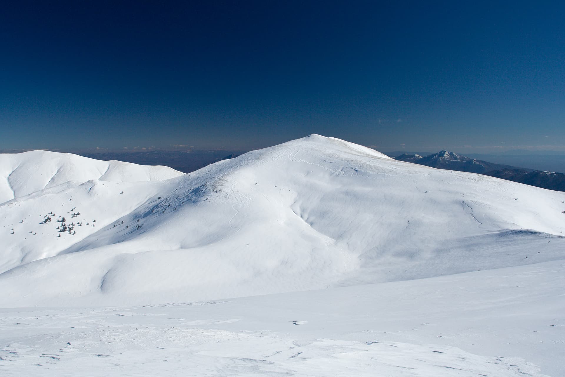
Late spring through early autumn (May–September) is best for Golena, when trails are clear of snow and weather is most stable. Higher peaks may hold snow into June and see fresh snow as early as October. Winter visits are for experienced mountaineers with proper gear.
Golena reaches an elevation of 2,633 metres above sea level.
Hiking boots, layered clothing, water (1.5–2 L per person), sun protection, and a windproof jacket — mountain weather changes quickly. For longer routes also bring a map (paper or offline), a head torch, and emergency rations. Tell someone your planned route and expected return time.