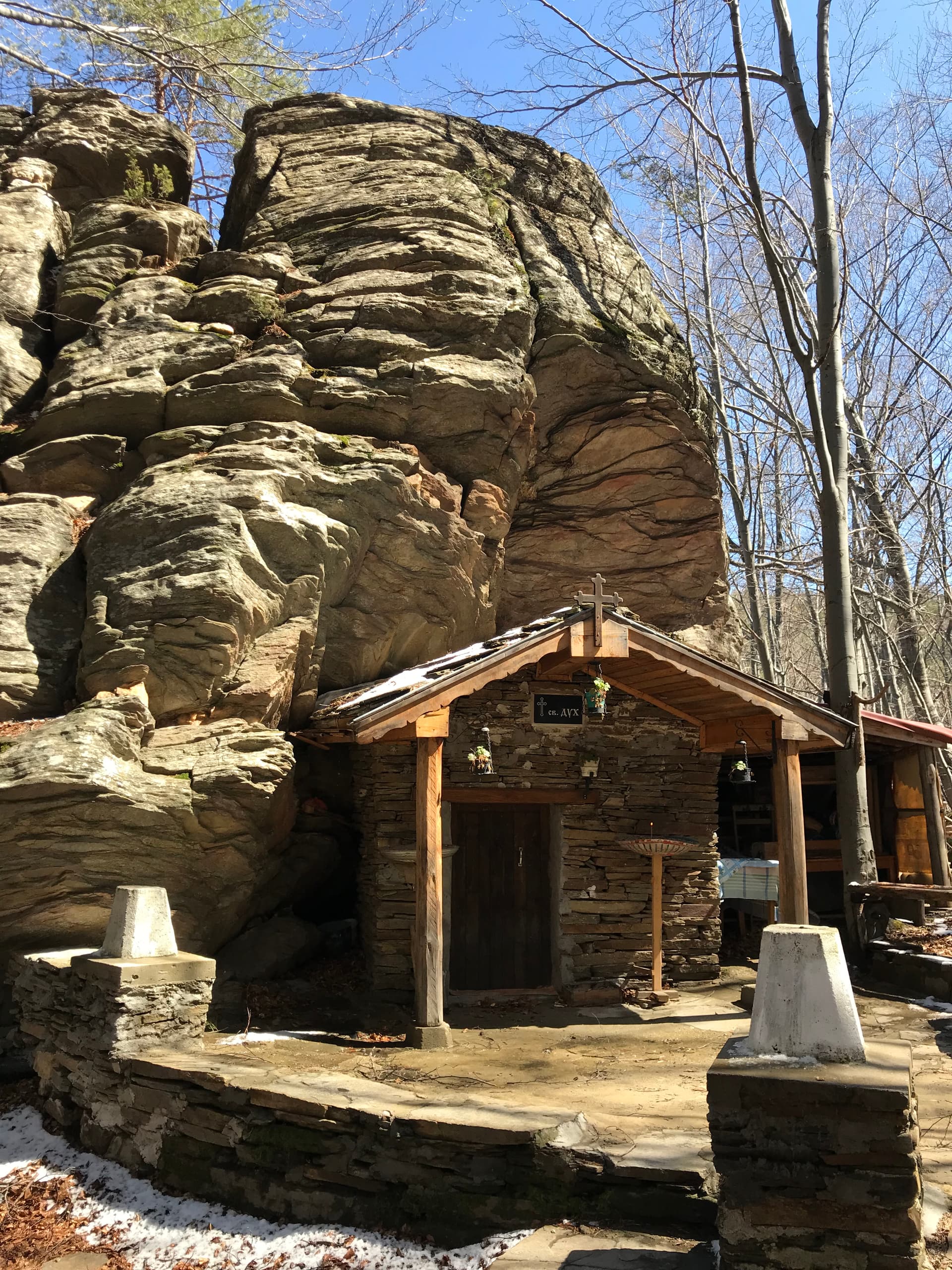
“Tarnlivia Vrah” (Thorn Peak) is one of the lesser-known but incredibly rewarding treasures of the Vrachanski Balkan, offering an unforgettable adventure for every true mountain lover. Located in the picturesque Vratsa region, this peak, though not as famous as some of its higher counterparts, enchants with its pristine nature and breathtaking panoramas. Its name, “Thorn Peak,” hints at a challenging but exceptionally rewarding trek – the trails to the summit wind through dense forests, dotted with bushes and rocky sections that test the spirit of the adventurer and guarantee a sense of accomplishment. The ascent to Tarnlivia Vrah is of moderate difficulty, requiring good physical preparation, but the effort is well worth it. From the summit, a magnificent 360-degree view unfolds over the Vratsa Valley, the dramatic cliffs of Vratsata Gorge, the distant peaks of the Central Balkan Mountains, and the green hills all around. In spring, its slopes are adorned with a carpet of wild flowers, while in autumn, an explosion of golden, red, and brown hues transforms the landscape, turning it into a true work of art. The area is home to diverse plant and animal species, making it an ideal spot for wildlife observation, birdwatching, and landscape photography. To reach Tarnlivia Vrah, you can take well-marked trails from nearby villages like Pavolche or from the vicinity of Vratsa city. Comfortable hiking gear, suitable footwear, and ample water are recommended, especially during the warmer months. This is the perfect destination for a day trip that will disconnect you from urban bustle and immerse you in the tranquility and grandeur of nature. “Tarnlivia Vrah” is not just a geographical point, but an experience that will leave lasting memories of the wild and authentic beauty of the Bulgarian mountains, inviting you to return again.

Montana
2.8 km away
Vratsa
6.9 km away
Vratsa
8.4 km away
Vratsa
8.8 km away
Tranliviya peak is located in Vratsa, Bulgaria.
Tranliviya peak is most easily reached by car. Use the coordinates above to navigate, or open the location in OpenStreetMap or your preferred maps app for turn-by-turn directions. Public transport options vary by region — for remote destinations a rental car gives the most flexibility.
Late spring through early autumn (May–September) is best for Tranliviya peak, when trails are clear of snow and weather is most stable. Higher peaks may hold snow into June and see fresh snow as early as October. Winter visits are for experienced mountaineers with proper gear.
Tranliviya peak reaches an elevation of 1,026 metres above sea level.
Hiking boots, layered clothing, water (1.5–2 L per person), sun protection, and a windproof jacket — mountain weather changes quickly. For longer routes also bring a map (paper or offline), a head torch, and emergency rations. Tell someone your planned route and expected return time.