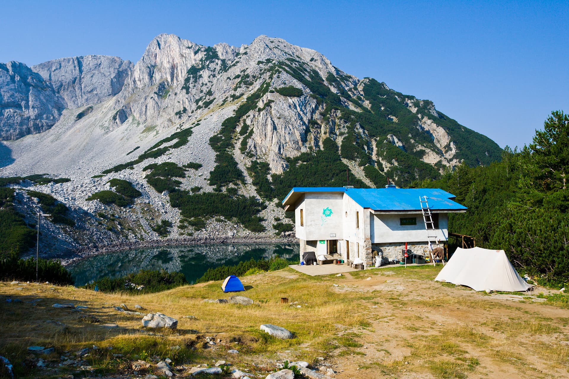
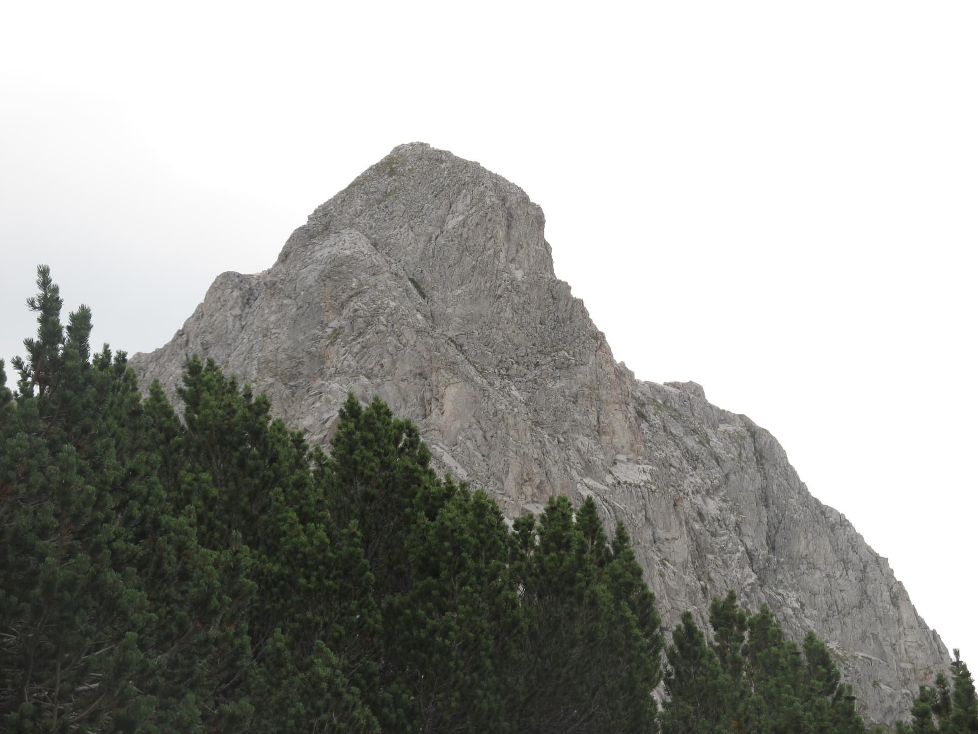
The trekking route from the non-operational Lagera Hut to Sinanitsa Hut is a true, rugged, and isolated backcountry experience in the Pirin Mountains. This trek is strictly not recommended for hikers with limited mountain experience, poor physical conditioning, or a fear of wildlife encounters. The trail crosses highly remote territories where summers mean completely overgrown paths and fallen trees, while winter and spring bring severe avalanche hazards along the steep couloirs. Route Parameters and Logistics - Starting Point: Lagera Hut (currently closed, but offers a convenient parking space for cars at the front). - Ending Point: Sinanitsa Hut and the adjacent mountain shelter. - Ascent Time (Winter/Spring Conditions): Approximately 5 hours of uphill climbing (including navigating and overcoming obstacles). The return trip is significantly faster. - Crucial Alternative: Local hikers strongly advise starting the trek from the Pescherata area instead of Lagera Hut to bypass the most neglected and overgrown section of the lower valley. Terrain Characteristics and Trail Obstacles - Stage 1 and River Crossings: At the start, the route follows an old, faded red trail marking, moving through thick brush and dirt roads. About 4-5 kilometers into the hike, you reach the first major river crossing at a mapped water catchment point, requiring wading through the cold flow. Afterwards, the path repeatedly crosses the Razkolska River, making wet boots almost inevitable. - The Lost Trail and Deadfall Barriers: After passing an abandoned sheepfold, the actual trail disappears completely. The area is heavily blocked by massive fallen old-growth trees and fresh debris, turning the hike into a slow scramble. While some stone cairns exist, off-trail navigation straight up the ridge line is frequently required to reconnect with the GPS track. - The Ridge and Sinanitsa Cirque: Upon reaching the high ridge, the terrain levels out (gaiters and winter boots are mandatory here if snow cover is present). The route unfolds into a spectacular view of Sinanitsa Peak, passing above one of the frozen lakes before reaching the safety of the hut. Avalanche Risks and Bear Country Safety - Avalanche Danger: The basin surrounding Sinanitsa Hut is highly prone to avalanches. Even during warm spring days, snow sluffs are common, and massive active avalanches can often be spotted sweeping down the slopes beneath the opposite Momin Grad Peak. Continuous snowpack evaluation is required. - Brown Bear Habitat: The valley of the Razkolska River is prime brown bear territory. Fresh paw prints, tufts of bear fur caught on tree bark, and distinct droppings are frequently encountered along the riverbeds, indicating that the animals are active. Hikers must shout, talk loudly, or use safety whistles periodically to announce their presence and avoid startling a bear at close range.
Blagoevgrad
2.9 km away
Blagoevgrad
3.8 km away

Blagoevgrad
4.4 km away
h. Lagera - h. Sinanitsa is located in Blagoevgrad, Bulgaria.
h. Lagera - h. Sinanitsa is most easily reached by car. Use the coordinates above to navigate, or open the location in OpenStreetMap or your preferred maps app for turn-by-turn directions. Public transport options vary by region — for remote destinations a rental car gives the most flexibility.
h. Lagera - h. Sinanitsa is best walked from May through October, when the trail is clear of snow and weather is generally stable. Summer middays can be hot at lower altitudes — start early. Winter walking requires proper gear and route knowledge.
Suitability depends on the specific route. Bulgarian trails range from paved family-friendly paths to multi-day high-mountain crossings. Check the length, elevation gain, and surface before setting off. Sturdy footwear, water, and a basic map (offline or paper) are essential even on short walks.