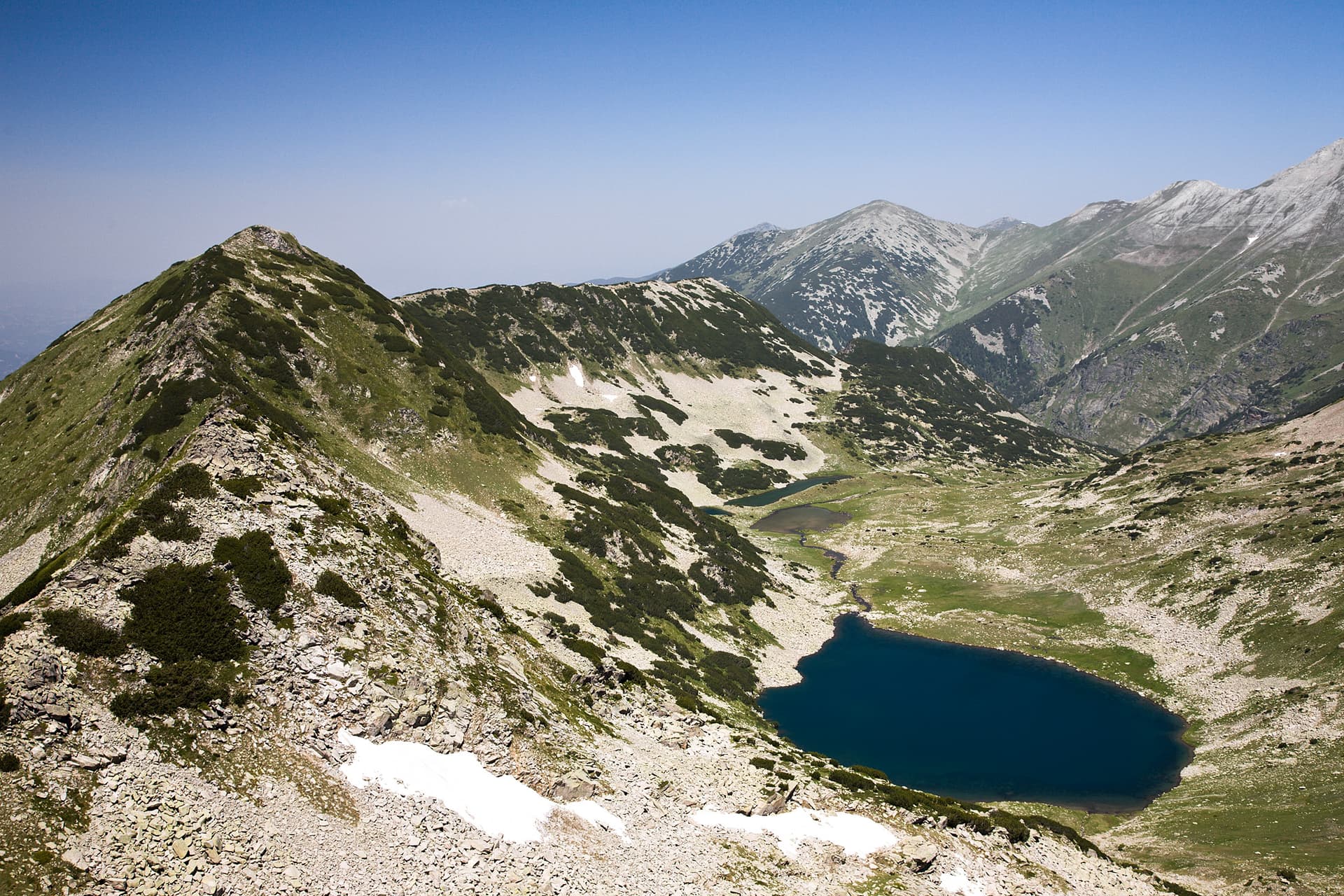
The trail from the Chernata Voda (Black Water) locality to Sinanitsa Hut is a classic yet less-frequented mountain trek in the Pirin Mountains. Passing through the rugged Vlahini Cirque and along the shores of pristine glacial lakes, this route is ideal for seasoned hikers looking to escape the crowded main paths and experience the wilder, untouched side of Pirin. Route Essentials - Duration: Approximately 4 to 5 hours. - Elevation Gain: Around 800 – 900 meters of positive ascent. - Difficulty: Moderately demanding. It requires solid physical fitness and good mountain navigation skills. Step-by-Step Trail Guide - The Trailhead (Chernata Voda): Located in a valley meadow where the Vlahinska River merges with a side stream. The area can be accessed via mountain roads from the town of Kresna or as an extension of a longer trek from Yavorov Hut. - The Ascent Through the Cirque: The path leads up toward the beautiful Vlahini Lakes (Upper and Lower). The most challenging section begins at the dwarf pine belt just below the lakes. Here, the trail climbs steeply, and hikers must carefully look for the cleared path through the thick brush. - Navigation and Orientation: Because this is an active grazing area, the actual tourist trail frequently blends with confusing livestock tracks. Carrying a pre-loaded GPS track or using a reliable alpine mapping app (such as BG Mountains) is highly recommended to stay on course. - Arriving at Sinanitsa: After clearing the lake basin, the trail emerges onto the panoramic Sinanitsa Ridge. From this vantage point, a smooth descent leads directly to Sinanitsa Hut, beautifully mirrored in the crystal-clear waters of Lake Sinanitsa. Accommodation and Practical Info at Sinanitsa Hut - Facilities: The hut sleeps about 50 people. It has running water and electricity, while the restrooms are located outside the main building. - Booking Requirements: Advanced booking with a deposit is strictly required. Always call the hut keeper before starting your trek to check the current high-altitude weather conditions and reconfirm your reservation.
Blagoevgrad
2.1 km away

Blagoevgrad
2.5 km away
Blagoevgrad
3.0 km away
Blagoevgrad
3.3 km away
Chernata voda - h. Sinanitsa is located in Blagoevgrad, Bulgaria.
Chernata voda - h. Sinanitsa is most easily reached by car. Use the coordinates above to navigate, or open the location in OpenStreetMap or your preferred maps app for turn-by-turn directions. Public transport options vary by region — for remote destinations a rental car gives the most flexibility.
Chernata voda - h. Sinanitsa is best walked from May through October, when the trail is clear of snow and weather is generally stable. Summer middays can be hot at lower altitudes — start early. Winter walking requires proper gear and route knowledge.
Suitability depends on the specific route. Bulgarian trails range from paved family-friendly paths to multi-day high-mountain crossings. Check the length, elevation gain, and surface before setting off. Sturdy footwear, water, and a basic map (offline or paper) are essential even on short walks.