MestalaMestala
HomePlacesMapTripBlogAboutFAQ
EN|БГ

Discover Bulgaria with Mestala.

AboutFAQLicensePrivacy
TrailsSofia City

Bistrishko Branishte Reserve

HomePlacesTrailsBistrishko Branishte Reserve
Elevation: 0 mCoordinates: 42.56422, 23.31017View on OpenStreetMap

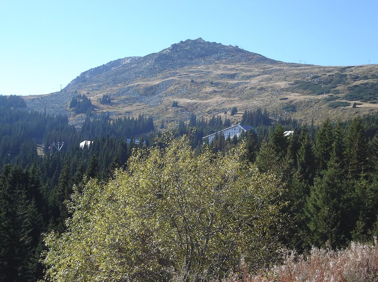
Bistrishko Branishte is one of Bulgaria's oldest and most significant nature reserves, established in 1934 to preserve the pristine high-mountain nature of Vitosha. Located on the northeastern slopes, the reserve serves as a vast "outdoor laboratory" for observing natural forest development and the dynamics of alpine vegetation. Status and International Recognition Founded in the same year that Vitosha became the first protected territory in the Balkans, the reserve boasts a long history: - 1977: It was designated a Biosphere Reserve under UNESCO's "Man and the Biosphere" program. - 2021: The reserve was excluded from the UNESCO program but remains under a strict protection regime according to Bulgarian law. - Objective: Complete prohibition of human intervention to preserve ancient spruce forests (some over 150 years old), sub-alpine shrubs, and unique meadows. Location and Topography The reserve covers 1,061.6 hectares and encompasses the drainage basins of the Bistritsa and Yanchovska rivers. - Altitude: Ranging from 1,430 to 2,286 meters (Golyam Rezen Peak). - Stone Rivers: One of the most striking features of the reserve is the "stone rivers" (moraines)—massive, randomly piled boulders that are iconic to Vitosha Mountain. Natural Processes and Ecology In recent decades, Bistrishko Branishte has gained global scientific interest following a massive storm in 2001 and a subsequent bark beetle outbreak. Because human intervention (such as sanitation logging) is strictly forbidden, scientists can observe how the forest regenerates naturally without human interference. Practical Information for Visitors - Access: Hiking is permitted only on marked trails. The main path connects Aleko Hut with the village of Zheleznitsa. - Rules: It is strictly forbidden to pick plants, light fires, or deviate from the designated paths. - Key Landmarks: Nearby is Golyam Kupen Peak (1,930 m), offering majestic views over the Bistritsa River valley.
Nearby Places

Zheleznitsa - h.Kupena - Cherni vrah
Trails

Zheleznitsa - h.Kupena - Cherni vrah

Sofia City

2.0 km away

Malak Resen
Mountains

Malak Resen

Sofia City

2.0 km away

Skoparnika
Mountains

Skoparnika

Pernik

2.0 km away

Cherni peak
Mountains

Cherni peak

Pernik

2.5 km away

More to explore

Zheleznitsa - Kokalyanski manastir
Trails

Zheleznitsa - Kokalyanski manastir

Sofia City

Bankya - hut Lyulin
Trails

Bankya - hut Lyulin

Sofia City

Zheleznitsa - h.Kupena - Cherni vrah
Trails

Zheleznitsa - h.Kupena - Cherni vrah

Sofia City

Rudartsi - hut Ostritsa
Trails

Rudartsi - hut Ostritsa

Sofia City

Frequently asked questions

Where is Bistrishko Branishte Reserve located?

Bistrishko Branishte Reserve is located in Sofia City, Bulgaria.

How do I get to Bistrishko Branishte Reserve?

Bistrishko Branishte Reserve is most easily reached by car. Use the coordinates above to navigate, or open the location in OpenStreetMap or your preferred maps app for turn-by-turn directions. Public transport options vary by region — for remote destinations a rental car gives the most flexibility.

What is the best time to visit Bistrishko Branishte Reserve?

Bistrishko Branishte Reserve is best walked from May through October, when the trail is clear of snow and weather is generally stable. Summer middays can be hot at lower altitudes — start early. Winter walking requires proper gear and route knowledge.

Is Bistrishko Branishte Reserve suitable for beginners?

Suitability depends on the specific route. Bulgarian trails range from paved family-friendly paths to multi-day high-mountain crossings. Check the length, elevation gain, and surface before setting off. Sturdy footwear, water, and a basic map (offline or paper) are essential even on short walks.