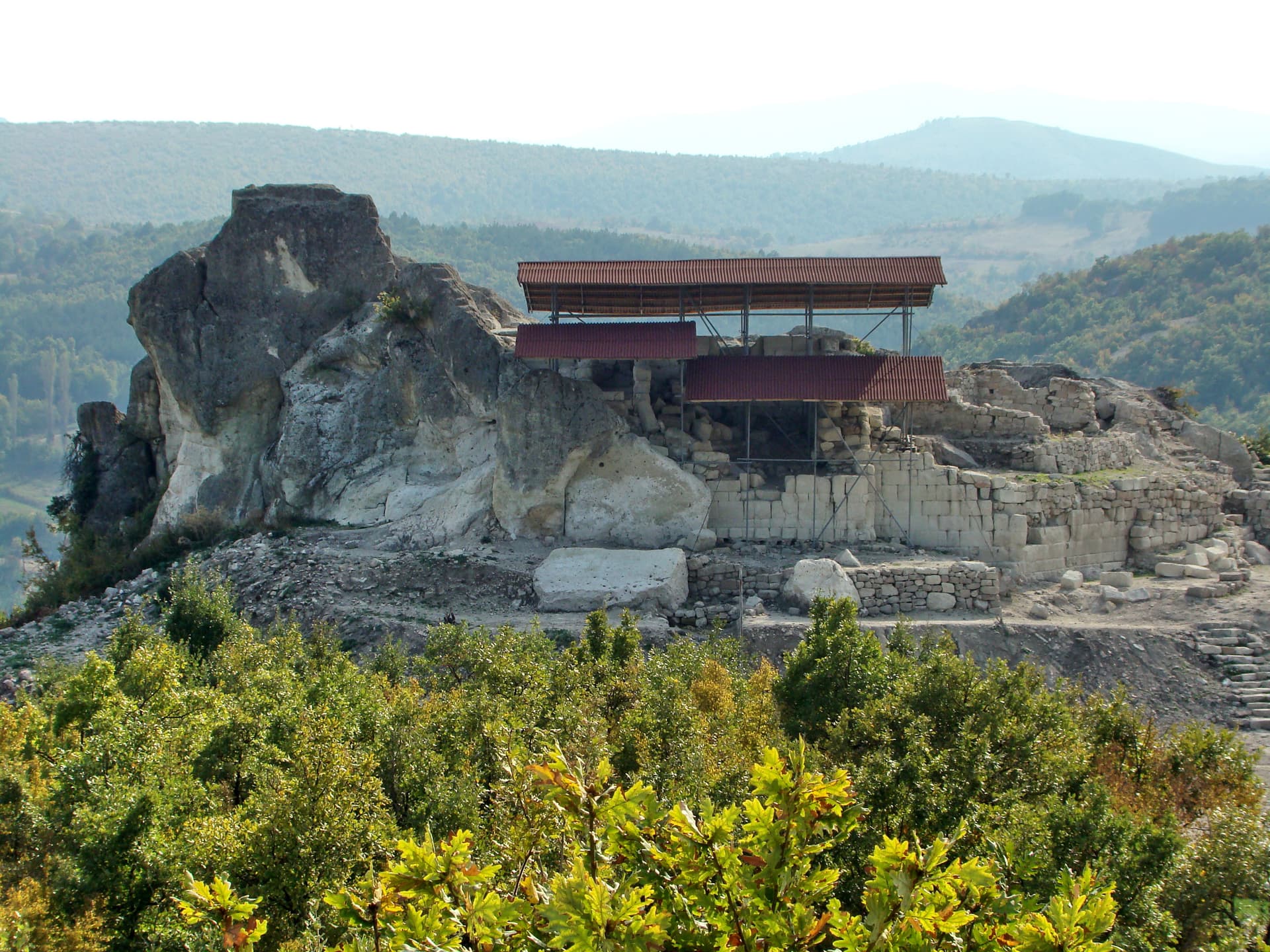
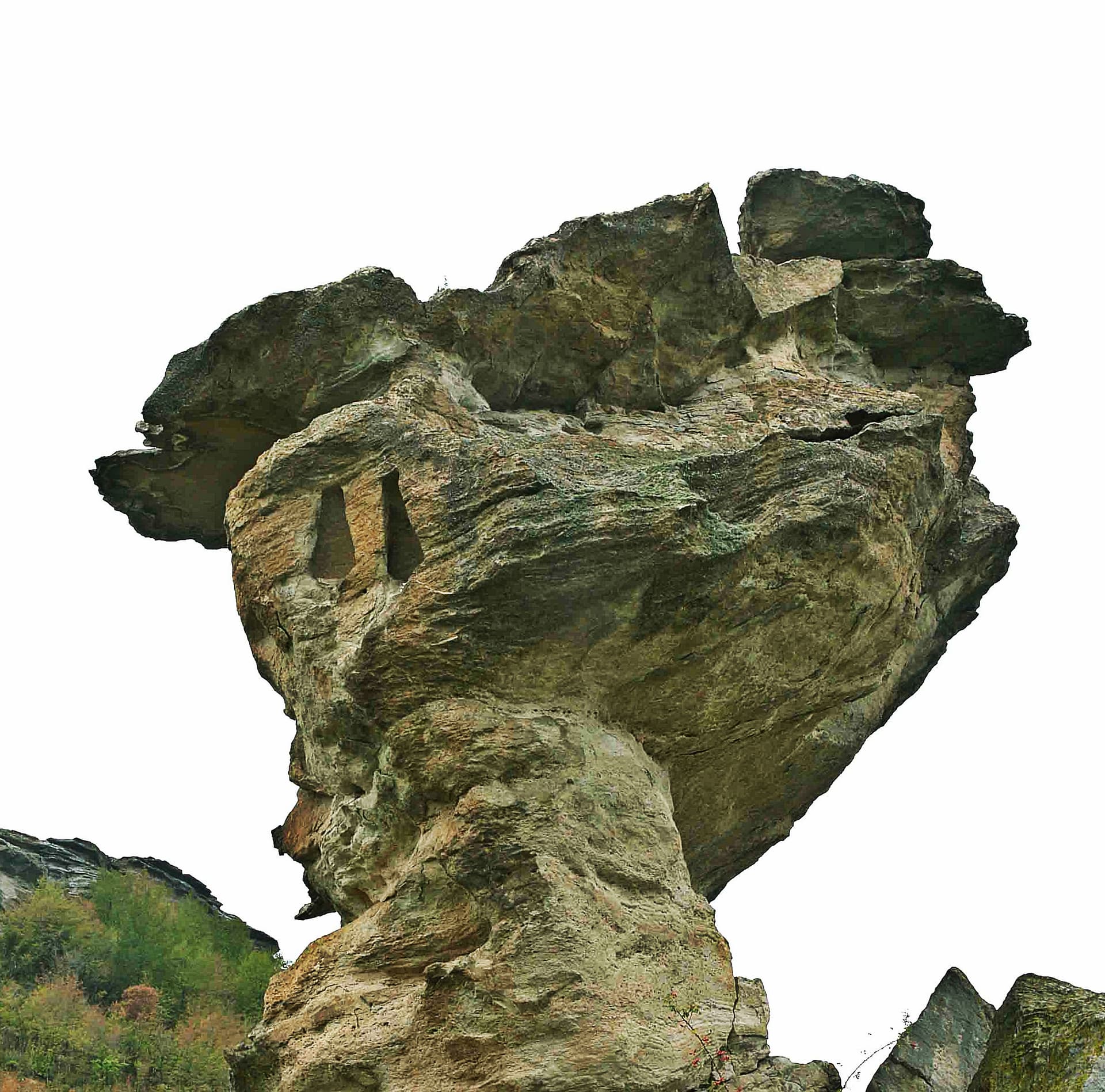
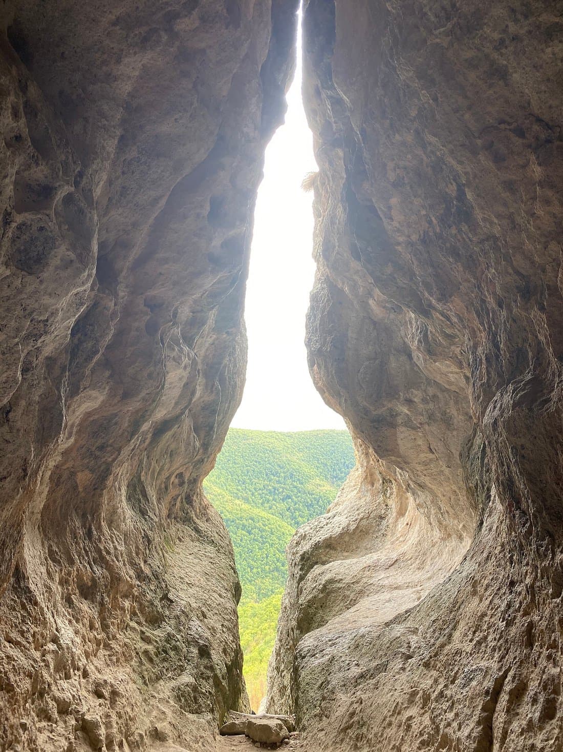
The Yumruk Kaya Fortress is one of the most imposing and strategically positioned ancient fortifications in the Eastern Rhodopes. Erected atop the peak of the same name, just 1.9 km southwest of the village of Gnyazdovo (Kardzhali municipality), it dominates the landscape near the scenic "Studen Kladenets" reservoir. Positioned on a flat plateau with ultimate natural defenses, the fortress preserves the remnants of several historical eras—stretching from the mysterious Thracian tribes to the border defense systems of the First Bulgarian Empire. Architecture and Thracian Fortifications - Natural Inaccessibility: The ancient Thracians chose the location with military precision. To the south and west, the plateau terminates in vertical, sheer rock faces, while the northern and eastern slopes are exceptionally steep. - The Monumental Rampart (600 m): To safeguard the only accessible approaches from the north and east, the Thracians constructed a massive defensive wall stretching approximately 600 meters. It traces the most vulnerable edges of the plateau. - Dry Stone Construction: The Thracian wall is about 2 meters wide and built entirely using the dry stone method—utilizing heavy quarry stones fitted together without any mortar or binding materials. Inside the fort, the foundations of large ancient structures remain clearly visible. Spirituality, Mysticism, and Medieval Sentinels - The Roman Chapel: About 200 meters east of the main fortress, on a smaller, isolated rocky ridge, a mysterious building was erected during the Roman era. Archaeologists suggest that due to its solitary, elevated position, it likely served as a sanctuary or an early chapel. - The Medieval Watchtower: At the highest point of the plateau, in its southwestern corner, a small citadel was established during the First Bulgarian Empire. It held key scouting and observation duties, monitoring troop movements throughout the valley. - The Secret of the Yellow-Red Clay: The medieval walls were bound together using a unique yellowish-red clay. This special natural mortar hardens to completely seal the structure against rain erosion and prevents any mountain plants from taking root between the stones (a traditional technology still seen in historic stone walls in Eastern Serbia). - The Ancient Highway: The strategic importance of Yumruk Kaya is further highlighted by a prominent ancient road that ran right along the foot of the hill, following the natural course of the Arda River.
Kardzhali
5.8 km away
Kardzhali
6.6 km away

Kardzhali
7.6 km away
Kardzhali
8.5 km away
Yumruk kaya is located in Kardzhali, Bulgaria.
Yumruk kaya is most easily reached by car. Use the coordinates above to navigate, or open the location in OpenStreetMap or your preferred maps app for turn-by-turn directions. Public transport options vary by region — for remote destinations a rental car gives the most flexibility.
Yumruk kaya can be visited year-round. Spring and autumn offer the most pleasant conditions for exploring, with mild temperatures and fewer crowds. Summer is ideal for photography and longer day trips; winter visits are possible but weather can limit access at some sites.
Most natural landmarks in Bulgaria are freely accessible and open year-round, though some sites have entrance fees or require a guide. Wear sturdy footwear and bring water, as the terrain can be uneven. Respect any protective barriers and stay on marked paths to preserve the site.