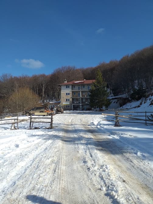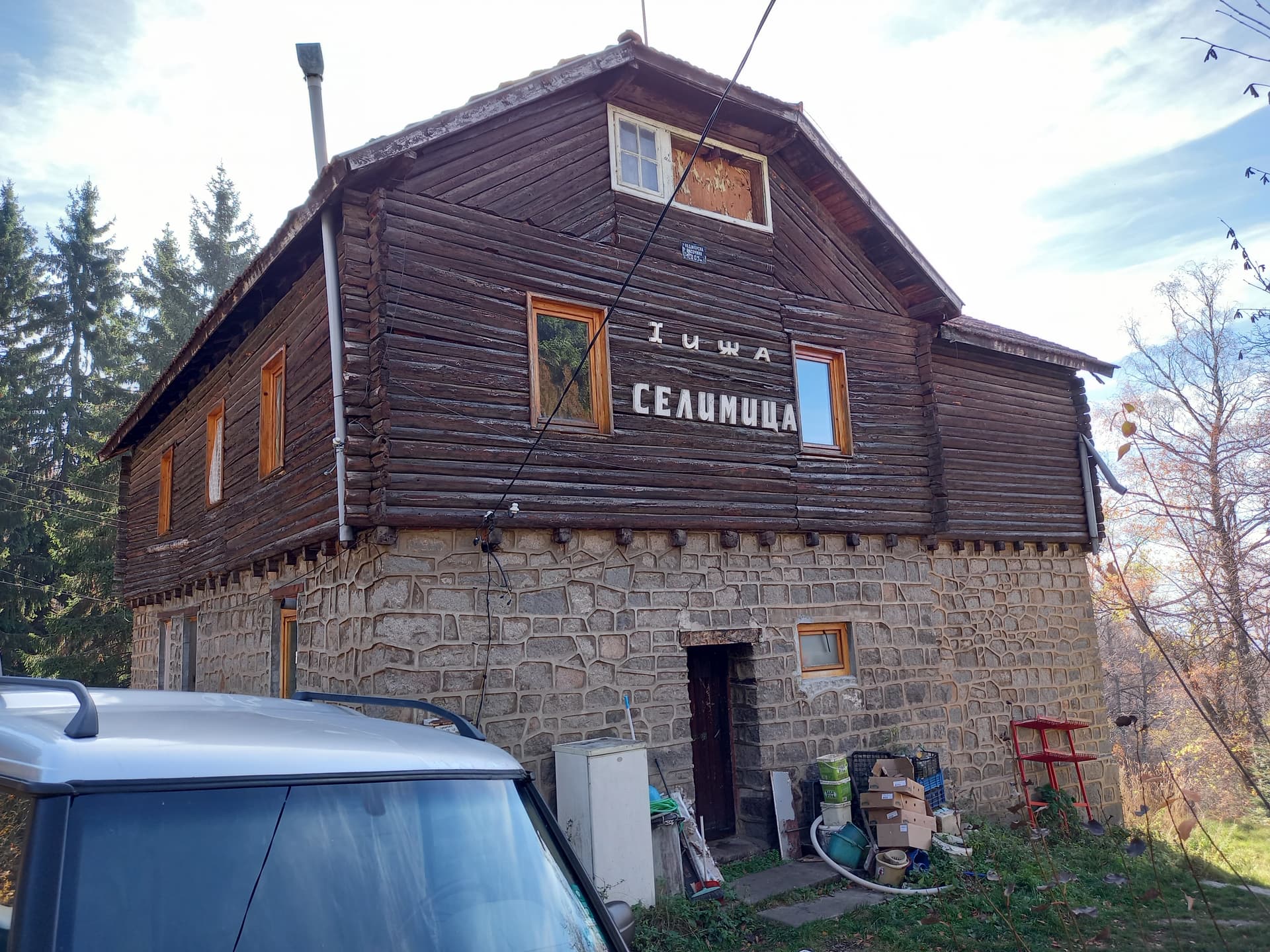
Selimitsa Peak (2,041 m) is one of the most distinctive and scenic summits in the southwestern section of the Vitosha Mountains. Situated west of Cherni Vrah, it impresses with its contrasting topography—steep and challenging southern and western slopes paired with a gentle, welcoming eastern ridge. The area surrounding the peak and its namesake hut is famous for its mild climate, ancient forests, and as a natural habitat for the European ground squirrel (Spermophilus citellus), found here up to 1,300 m above sea level. Nature, Waterfalls, and Landmarks - The Kladnica Health Trail: The path leading from the village to the hut takes you along the picturesque gorge of the Kladnishka River. Shaded by trees, the trail crosses several wooden bridges, revealing beautiful small waterfalls, rapids, and river cascades. - The Epiphany Crosses: Along the route, hikers pass the traditional spot where locals plunge into the freezing waters to retrieve the cross on Epiphany day. The place is easily recognized by two large crosses standing by the river—one made of stone and the other of iron. - The Stone River: Right next to the "Selimitsa" Hut lies an impressive moraine stream (stone river)—one of Vitosha’s signature geological phenomena. Route Overview, Accessibility, and Logistics - The Trek: The main forest trail starts roughly 500 meters past the end of Kladnica village (marked by a wooden bridge). The hike up to the hut is easy, well-defined with red trail markings, and takes about 40–50 minutes with an elevation gain of 300 meters. The descent takes 30–40 minutes, making it a fantastic weekend escape for families with young children. - By Car to Kladnica: From the Sofia–Pernik main road (via Vladaya), turn left at the traffic light in Dragichevo, drive through Rudartsi, and ascend to Kladnica. From the village, an asphalt road continues all the way up to the hut. - By Public Transport: A direct shuttle service connects Sofia (starting behind the Ministry of Agriculture / Russki Pametnik) to the village. From Pernik, take bus No. 21 to Vitosha Square in Kladnica (add an extra 15-minute walk from the bus stop to the forest trail entrance). Selimitsa Hut and Hiking Junctions - Hut Facilities: Situated at 1,305 m above sea level, the mountain lodge offers warm food, drinks, and overnight accommodation. The surrounding meadows are equipped with picnic areas, benches, tables, and playgrounds, while the front parking lot accommodates up to 40 vehicles. - A Gateway to the Peak: The hut is a prime base for longer and more advanced mountain treks. Several marked trails branch out from here: - Cherni Vrah: A scenic summer route crossing the "Sedloto" saddle (3 hrs 15 mins, red markings) and a winter stake-marked route. - Sopo Shelter: A short, easy walk (about 20 mins, green or winter stake markings). - Chuypetlovo Village: A deeper trek into the quiet side of the mountain (around 3 hrs, green markings). - Zlatnite Mostove (Golden Bridges): Winding past the Ostoritsa and Edelweiss huts (green markings). - To Vladaya, Rudartsi, and Marchaevo: Following the yellow trail markings.

Sofia City
2.6 km away
Pernik
2.9 km away
Sofia City
3.2 km away

Pernik
3.3 km away
Selimitsa is located in Sofia City, Bulgaria.
Selimitsa is most easily reached by car. Use the coordinates above to navigate, or open the location in OpenStreetMap or your preferred maps app for turn-by-turn directions. Public transport options vary by region — for remote destinations a rental car gives the most flexibility.
Late spring through early autumn (May–September) is best for Selimitsa, when trails are clear of snow and weather is most stable. Higher peaks may hold snow into June and see fresh snow as early as October. Winter visits are for experienced mountaineers with proper gear.
Selimitsa reaches an elevation of 2,041 metres above sea level.
Hiking boots, layered clothing, water (1.5–2 L per person), sun protection, and a windproof jacket — mountain weather changes quickly. For longer routes also bring a map (paper or offline), a head torch, and emergency rations. Tell someone your planned route and expected return time.