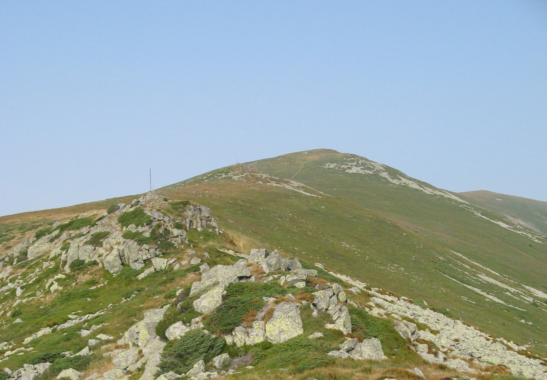
The route from the mountain village of Ribaritsa to Benkovski Hut along the Zavodna River valley is one of the safest and most gradual ways to venture into the deep wilderness of the Central Balkan National Park. Although longer than the alternative trail passing through the historical Kostina area, this option is highly favored by hikers due to the minimal risk of getting lost and the smooth, steady gain in elevation. The trek follows a well-defined dirt logging road for most of the way, making it technically easy though somewhat monotonous through the forested section within the Tsarichina Reserve. However, the ultimate reward for your patience is the majestic, sweeping alpine panoramas of the main Balkan ridge that open up near the end of the journey. Key Parameters and Route Logistics - Starting Point: The town hall (Kmetstvo) of Ribaritsa village. - Ending Point: Benkovski Hut (1,598 meters above sea level). - Duration: Approximately 5 hours of steady, casual walking. - Marking: Excellent and clearly visible red trail markings. Since the route sticks to a primary forest road, the chance of making a wrong turn is practically zero. - Terrain and Footing: The first 7 km are on an asphalt road, followed by a long section of crushed-stone macadam surface that requires sturdy hiking boots with stiff soles. Only the final 700–800 meters before reaching the hut transition into a classic mountain forest singletrack trail. - Water and Shade: The trail is open and exposed for the first hour. Upon entering the national park boundaries, the dense forest provides deep, cool shade for nearly 3 hours, before you finally break out onto the open ridges below the summits. There are several reliable freshwater springs scattered along the way. - Free Vehicle Access: A unique feature of this route is that the road along the Zavodna River is one of the few trails with unrestricted public vehicle access inside the national park. Using a standard car can save you from walking the first 7 km of asphalt, and a high-clearance 4x4 off-road vehicle can take you even further up the mountain, significantly shortening the overall hiking time. - Potential Hazards: There are no steep or dangerous sections along this trail. The only thing to keep in mind is the presence of a few high-altitude shepherd huts (koshari) near the road. It is wise to stay alert due to the presence of livestock guarding dogs (Karakachan shepherds), though most of them are well-accustomed to the seasonal flow of tourists. Step-by-Step Trail Description 1. From the Village to the Park Boundary: The trek begins at the Ribaritsa town hall, heading east along the main asphalt road. Just before reaching the bridge over the Zavodna River, turn right onto the road that follows the river's path. After about 4 km (approximately 1 hour of walking), you will pass the official boundary of the Central Balkan National Park and enter the refreshing shade of the forest. 2. The Bratanitsa Ridge and Trail Junctions: At the 7 km mark (roughly 2 hours from the start), the asphalt road ends right past the trailhead for the popular Tsarichina Eco-trail. Around the 9 km mark, the road crosses the river via a bridge, makes a sharp hairpin turn, and begins to wind its way up the slopes of the Bratanitski Ridge. Here, you will pass the first turnoff for Vezhen Hut. A critical navigation point occurs at the 12.5 km mark (~3.5 hours from the start), where a clearly signed fork points left toward Vezhen Hut, while you must continue straight ahead to stay on track for Benkovski Hut. 3. Alpine Panoramas and the Final Stretch: After another 40 minutes of steady walking, the forest suddenly opens up as you reach the high ridge line. An impressive frontal view of the highest peaks instantly unfolds before you, showcasing Vezhen (2,198 m), Bratanitsa (1,992 m), Baluvanya (2,043 m), and Tetevenjska Baba (2,070 m). The road winds through the meadows beneath these giants for about half an hour, offering unforgettable mountain vistas, before entering a small patch of woods for the final 15-minute walk to Benkovski Hut. Route Extensions and Loop Options To avoid a repetitive and long walk back along the same gravel road, mountaineers have an excellent opportunity to close a circular loop trip: - Descent via the Kostina Area: This is the second main trail connecting the hut back down to Ribaritsa. It passes directly by the historic site where the revolutionary leader Georgi Benkovski was killed. The path here is steeper and more dynamic, making it highly enjoyable for a descent, though it requires extra caution in wet or muddy conditions. - High Ridge Ridge-Walking: Benkovski Hut serves as an ideal base for summiting Tetevenjska Baba and Vezhen peaks. From the hut, you can easily embark on longer, multi-day Balkan ridge-traverses heading west toward Momina Polyana Hut and Paskal Hut, or heading east toward Eho Hut. - Southward Crossings: For those interested in point-to-point through-hikes, the main mountain spine can be crossed in a southward direction, descending down to the historic town of Koprivshtitsa or the village of Anton via the Anton Pass.

Lovech
2.8 km away
Lovech
3.9 km away
Lovech
6.2 km away
Plovdiv
6.7 km away
Ribaritsa - h.Benkovski (po r.Zavodna) is located in Lovech, Bulgaria.
Ribaritsa - h.Benkovski (po r.Zavodna) is most easily reached by car. Use the coordinates above to navigate, or open the location in OpenStreetMap or your preferred maps app for turn-by-turn directions. Public transport options vary by region — for remote destinations a rental car gives the most flexibility.
Ribaritsa - h.Benkovski (po r.Zavodna) is best walked from May through October, when the trail is clear of snow and weather is generally stable. Summer middays can be hot at lower altitudes — start early. Winter walking requires proper gear and route knowledge.
Suitability depends on the specific route. Bulgarian trails range from paved family-friendly paths to multi-day high-mountain crossings. Check the length, elevation gain, and surface before setting off. Sturdy footwear, water, and a basic map (offline or paper) are essential even on short walks.