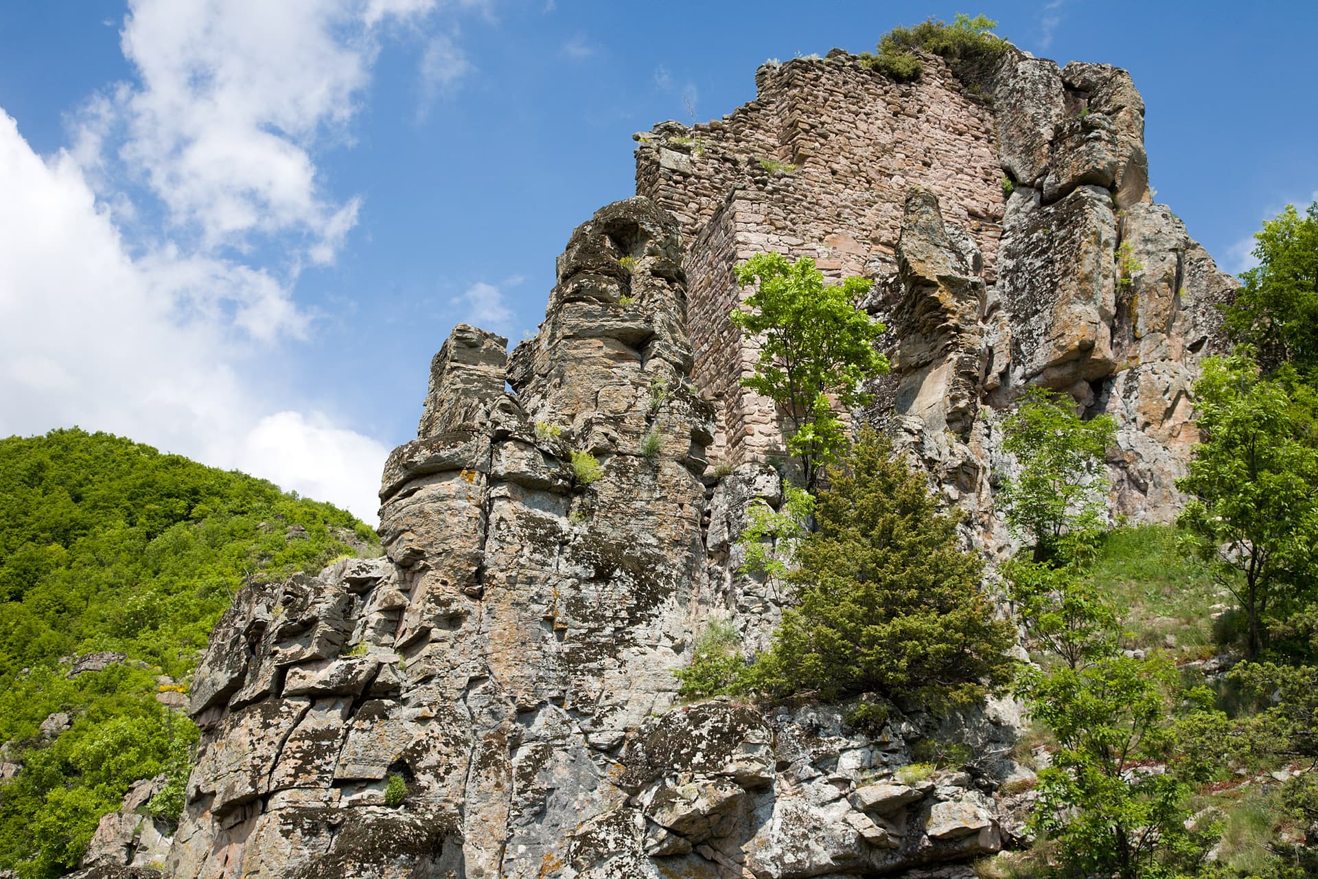
Momina Kula, known by the older name Kaz Kalesi, is a Late Antique and medieval fortress in the Momina Klisura gorge of the Mesta river near the village of Kremen, on the south-eastern slopes of Pirin, about 16 km north-west of Gotse Delchev. It is a national archaeological monument.
The fortress stands on a hilltop with sheer rock slopes to the north, east and south, on the right bank of the Mesta, right by the road to Gotse Delchev, which it guarded. It covers two terraces of about 500 m². To the east are the foundations of a square tower (5.4 × 6.2 m); the wall is only on the west, which is also the only way in, and it stands about 5 m high along its whole length. The entrance with a tower is also on the west, and the drop is overcome by steps cut into the rock. In the rocks below the fortress is a cave with several entrances, passages and halls that held a prehistoric dwelling, with symbols cut into the walls; its entrances are walled up and there is no access.
The fortress was probably built in the 2nd–3rd centuries, later abandoned, and rebuilt in the 12th century; pottery from the 5th–6th and 12th–14th centuries has been found inside. Legends tell of a girl who threw herself from the fortress to escape capture, and of a giant maiden, sister of Krali Marko. Another links its rebuilding to Kera Tamara, sister of Tsar Ivan Shishman. Peyo Yavorov (1903) and the archaeologist Bogdan Filov (1915) both passed by the fortress.
The fortress is about 5.6 km south-east of the centre of Kremen in a straight line, on the road down the Mesta valley to Gotse Delchev. The only access is from the west.

Blagoevgrad region
9.1 km away
Blagoevgrad region
11.4 km away
Blagoevgrad region
13.9 km away
Blagoevgrad region
14.1 km away
Momina Kula Fortress is located in Blagoevgrad, Bulgaria.
Momina Kula Fortress is most easily reached by car. Use the coordinates above to navigate, or open the location in OpenStreetMap or your preferred maps app for turn-by-turn directions. Public transport options vary by region — for remote destinations a rental car gives the most flexibility.
Momina Kula Fortress can be visited year-round. Spring and autumn offer the most pleasant conditions for exploring, with mild temperatures and fewer crowds. Summer is ideal for photography and longer day trips; winter visits are possible but weather can limit access at some sites.
Most natural landmarks in Bulgaria are freely accessible and open year-round, though some sites have entrance fees or require a guide. Wear sturdy footwear and bring water, as the terrain can be uneven. Respect any protective barriers and stay on marked paths to preserve the site.