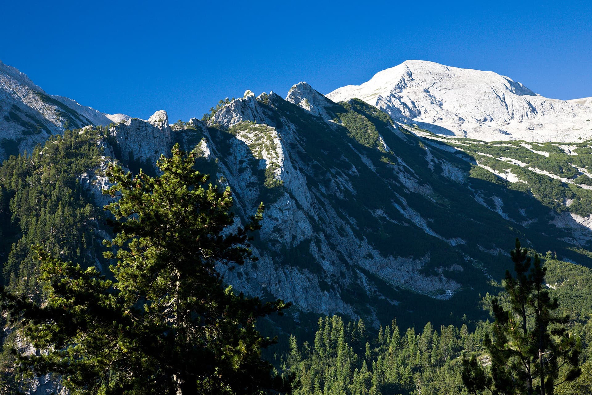
The trail from Yavorov Hut to Kamenitishki Preval is one of the most picturesque and accessible adventures that Northern Pirin offers. This moderate hiking route, starting from Yavorov Hut (1740 m a.s.l.) in the Blagoevgrad region, is ideal for those who wish to immerse themselves in the mountain's beauty without extreme challenges. The route begins at the hut, winding through dense coniferous forests that gradually give way to vast alpine meadows with panoramic views. The path is well-marked with a gentle ascent, making it suitable for families with children or less experienced hikers. You'll have the opportunity to enjoy the fresh mountain air and breathtaking landscapes towards the Razlog Valley and the Rila Mountains in the distance. The culmination is Kamenitishki Preval (approx. 2400 m a.s.l.) – a natural saddle that reveals a magnificent panorama of Pirin's majestic peaks, including Vihren and Koncheto, as well as the Pirinska Bistritsa River valley. The pass is also an important crossroads for other routes in the mountain. The one-way trek takes about 3-4 hours, providing an excellent opportunity for a day trip filled with unforgettable moments amidst Pirin's wild nature.

Blagoevgrad
1.7 km away
Blagoevgrad
1.7 km away
Blagoevgrad
1.9 km away
Blagoevgrad
2.7 km away
Hut Yavorov - Kamenitishki preval is located in Blagoevgrad, Bulgaria.
Hut Yavorov - Kamenitishki preval is most easily reached by car. Use the coordinates above to navigate, or open the location in OpenStreetMap or your preferred maps app for turn-by-turn directions. Public transport options vary by region — for remote destinations a rental car gives the most flexibility.
Hut Yavorov - Kamenitishki preval is best walked from May through October, when the trail is clear of snow and weather is generally stable. Summer middays can be hot at lower altitudes — start early. Winter walking requires proper gear and route knowledge.
Suitability depends on the specific route. Bulgarian trails range from paved family-friendly paths to multi-day high-mountain crossings. Check the length, elevation gain, and surface before setting off. Sturdy footwear, water, and a basic map (offline or paper) are essential even on short walks.