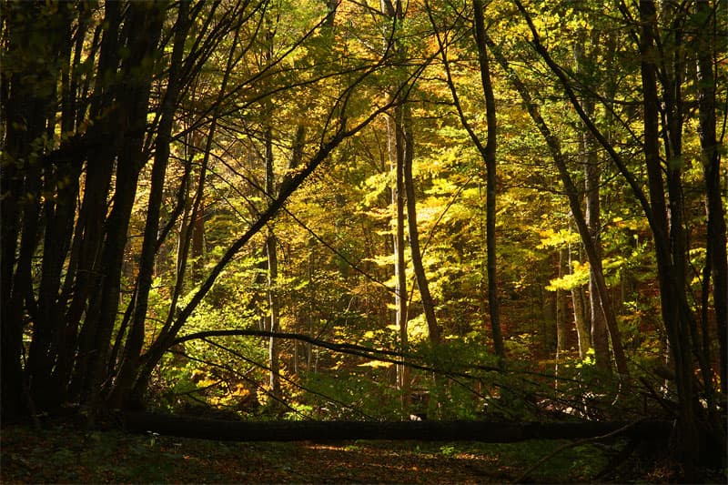
Karandila Hut is nestled in the heart of the iconic Karandila area, which forms an essential part of the Sinite Kamani (The Blue Stones) Nature Park. Perched at an altitude of 950 meters above sea level in the Sliven Balkan, the hut offers perfect accommodation for both enthusiastic hikers and families looking for a relaxing getaway in nature. The Sinite Kamani rock massif itself is composed mainly of specific quartz rocks, which amaze visitors with their whimsical shapes and unique shifting blue-grey colors. Hut Facilities and Amenities Karandila Hut is a solid, well-maintained three-story building. It is fully supplied with running water, electricity, and features a reliable local central heating system for the cold winter months. Inside, there is a cozy restaurant and cafeteria where travelers can enjoy traditional warm dishes and drinks. For the comfort of its guests, the hut provides rooms equipped with private bathrooms, TV, and wireless internet (Wi-Fi). The total guest capacity includes: - 3 double rooms. - 1 triple room. - 4 quadruple rooms. - A tourist dormitory room with 8 beds (ideal for larger groups of hikers). How to Get to Karandila Hut (Logistics and Directions) The area is highly accessible and offers several different transportation options depending on your travel style: - Hiking Trails: For trekking enthusiasts, the climb from the city of Sliven takes between 1.5 and 2 hours. You can choose either the scenic trail passing by the Golyam Chatalka peak or tackle the legendary and steep Hajduk Trail (Haydushka Pateka). - By Chairlift: For those who want to save energy and enjoy bird-eye views, the open-air chairlift connects the base station in Sliven to the top of Karandila in just 20 minutes. - By Car: The hut can easily be reached via a fully paved and well-maintained asphalt road, which is about a 30 km drive from the city of Sliven. Activities, Sports, and Leisure in Karandila The excellent conditions for sports, recreation, and relaxation make this area one of the most beloved symbols of the city of Sliven. The mountain complex offers top-tier facilities for mountain biking (MTB), rock climbing, orienteering, hang gliding, paragliding, and other extreme outdoor activities. The park is also famous for its healing clean air. The specific mild year-round climate has proven highly beneficial for people recovering from asthma and various lung conditions. If you are not a fan of extreme adventures, the vast ancient deciduous forests, spacious green meadows, and peaceful mountain atmosphere provide wonderful opportunities for light walks, picnics, and relaxation. The area surrounding the hut is dotted with natural wonders and historical sites inspired by local rebel legends. Must-see tourist attractions include: - The Halkata (The Ring) rock phenomenon, which is the official symbol of the park. - The peaks of Balgarka (the highest point in the park), Kutelka, Golyam Chatalka, and Malak Chatalka. - The Zmeyovi Dupki (Dragon Holes) cave. - The majestic rock formations of Kuminite, Kuklite, and Kaloyanova Kula (Kaloyans Tower). The area frequently hosts outdoor sports competitions, youth forums, and annual cultural festivals. All of this makes Karandila a top-tier destination for every traveler, with Karandila Hut standing as the best and most welcoming stop along the way.

Sliven
1.5 km away
Sliven
1.9 km away
Sliven
2.9 km away
hizha Karandila is located in Sliven, Bulgaria.
hizha Karandila is most easily reached by car. Use the coordinates above to navigate, or open the location in OpenStreetMap or your preferred maps app for turn-by-turn directions. Public transport options vary by region — for remote destinations a rental car gives the most flexibility.
hizha Karandila is best walked from May through October, when the trail is clear of snow and weather is generally stable. Summer middays can be hot at lower altitudes — start early. Winter walking requires proper gear and route knowledge.
Suitability depends on the specific route. Bulgarian trails range from paved family-friendly paths to multi-day high-mountain crossings. Check the length, elevation gain, and surface before setting off. Sturdy footwear, water, and a basic map (offline or paper) are essential even on short walks.